Fryderyk Getkant
[2] From the 1620s he worked in Pomeranian Voivodeship – Polish–Lithuanian Commonwealth, on the problems of defence, especially those related to King Władysław IV Vasa short-time maritime interests (Polish–Lithuanian Commonwealth Navy).
[3] He was one of the engineers working on fortifications in Großendorf (Władysławowo) and at Hela where Pomerania and Royal Prussia meet, (now Hel Peninsula) together with Johann Pleitner.
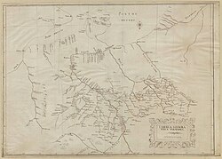
He also prepared city plans for Kaunas, Tauragė and Virbalis.
Author of many plans, maps and atlases (especially of the lands near the Baltic Sea), among them, manuscript atlas of 15 military maps of grand fortresses and fortifications – Topographia practica conscripta et recognita per Fridericum Getkant, mechanicum[4] (1638).
This biographical article related to the German Army is a stub.