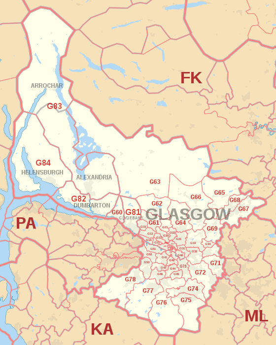
G postcode area
The G postcode area, also known as the Glasgow postcode area,[2] is a group of postcode districts in central Scotland, within six post towns.
These districts are primarily centered on Glasgow itself, and West Dunbartonshire (including Dumbarton, Clydebank and Alexandria), plus parts of the council areas of Argyll and Bute (including Arrochar and Helensburgh), East Dunbartonshire, North Lanarkshire, South Lanarkshire, East Renfrewshire and Stirling.
Mail for the G postcode area is processed at Glasgow Mail Centre, along with mail for the PA, ML, KA and ZE postcode areas.
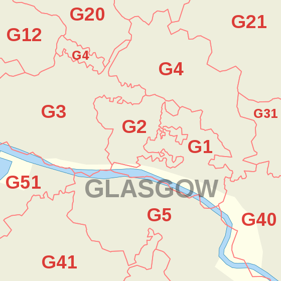
From 1923 until the introduction of the national postcode system in the late 1960s, Glasgow was divided into (mostly) numbered postal districts for its central and surrounding parts identified by compass-point letters: C1–C5 (corresponding to current postcode districts G1–G5), W1–W5 (G11–G15), NW (G20), N1–N3 (G21–G23), E1–E4 (G31–G34), SE (G40), S1–S6 (G41–G46) and SW1–SW3 (G51–G53).
[3][4] The approximate coverage of the postcode districts: