Geographical midpoint of Europe
The extreme southern parts of Europe are Cabo da Roca, A historical place in Portugal, Punta de Tarifa, the southernmost point on the Spanish mainland, and Gavdos, an island in Greece under the administrative region of Crete.
The first official declaration of the Centre of Europe was made in 1775 by the Polish royal astronomer and cartographer Szymon Antoni Sobiekrajski, who calculated it to be in the town of Suchowola[9] near Białystok in modern north-eastern Poland.
The interpretation of the worn Latin inscription on the monument is debated, with some claiming that the marker is merely one of a number of fixed triangulation points for surveying purposes established around the territory of the former empire.
According to the description, the methodology used for the calculation is that of the geometrical middle point of the extreme latitudes and longitudes of Europe, so the stone was located at 48°30′N 23°23′E / 48.500°N 23.383°E / 48.500; 23.383.
This is near the village of Dilove located on the Tisza river, close to the Romanian border, in the county of Rakhiv in the Transcarpathian region.
Measurements done after World War II by Soviet scientists reconfirmed the Austria-Hungarian claim that Rakhiv and Dilove to be the geographical centre of Europe.
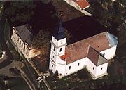
[citation needed] Austrian geographers also marked the 939-metre-high Tillenberg (Dyleň) near the Bohemian city of Eger/Cheb with a copper plate as the centre of Europe.
A monument, composed by the sculptor Gediminas Jokūbonis and consisting of a column of white granite surmounted by a crown of stars, was erected at the location in 2004.
An area of woods and fields surrounding the geographic centre point and including Lake Girija, Bernotai Hill, and an old burial ground, was set aside as a reserve in 1992.
The State Tourism Department at the Ministry of Economy of Lithuania has classified the Geographic Centre monument and its reserve as a tourist attraction.
[19] The French Institut Géographique National (IGN) has been calculating the changing location of what it estimates to be the geographical centre of the European Union (EU) since at least 1987.
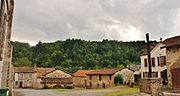
In 1990, the centre shifted some 25 km north-eastward, to the place called Noireterre in the village of Saint-Clément, département of Allier, the same région of Auvergne.

Dilove (Rakhiv, Ukraine), Krahule (or Kremnické Bane , Slovakia), Dresden and Kleinmaischeid (Germany), Toruń and Suchowola (Poland), Bernotai , or Purnuškės (Lithuania)