Geography of Armenia
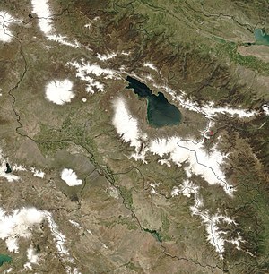
[5][6] Twenty-five million years ago, a geological upheaval pushed up the Earth's crust to form the Armenian Plateau, creating the complex topography of modern Armenia.
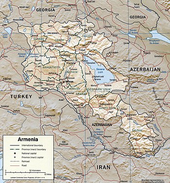
[4] The Lesser Caucasus range extends through northern Armenia, runs southeast between Lake Sevan and Azerbaijan, then passes roughly along the Armenian-Azerbaijani border to Iran.
[4] In December 1988, the second largest city in the republic, Leninakan (now Gyumri), was heavily damaged by a massive quake that killed more than 25,000 people.
[4] Most of the population lives in the western and northwestern parts of the country, where the two major cities, Yerevan and Gyumri, are located.
[4] The valleys of the Debed and Akstafa rivers form the chief routes into Armenia from the north as they pass through the mountains.
[4] Despite the harshness of winter in most parts (with frosts reaching −40 °C (−40 °F) and lower in Shirak region[citation needed]), the fertility of the plateau's volcanic soil made Armenia one of the world's earliest sites of agricultural activity.
Some copper-molybdenum and polymetallic ore deposits are rich in elements such as bismuth, tellurium, selenium, gallium, indium, thallium, rhenium and germanium.
That is the main reason why since ancient times inhabitants have built water reservoirs and irrigation canals in the area.