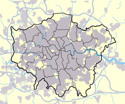
Geography of London
When more bridges were built in the 18th century, the city expanded in all directions as the mostly flat or gently rolling countryside presented no obstacle to growth.
The river cuts into the London basin through the Goring Gap, draining parts of the Cotswolds and Vale of Aylesbury to the west.
The threat has increased over time due to a slow but continuous rise in high water level, caused by both the slow 'tilting' of Britain (up in the north and down in the south) caused by post-glacial rebound and the gradual rise in sea levels due to climate change.
[2] Within London a considerable number of rivers and streams flow into the Thames, some large enough to have exerted a significant influence on the geography of the area.
A second significant corridor of canal, railways and industries was associated with the Brent, stretching from the Thames at Brentford, through Isleworth, Greenford, Alperton and Park Royal.
Smaller, some mainly subterranean tributaries include the Hogsmill River, Beverley Brook, Neckinger and Effra.
The Wandle formed south London's nearest equivalent to the Lea Valley, with an industrial corridor stretching from the Thames at Wandsworth through Merton and Mitcham to Beddington and Croydon.
Initially used for transport of agricultural product from Hertfordshire, this later became an important industrial waterway connecting the heavily industrialised Lea Valley with the docks.
A short-cut to the Thames avoiding the winding mouth of the Lea (Bow Creek) and closer to central London was provided by the Limehouse Cut (1760).
The centre of the basin is dominated by the modern valley of the Thames, which forms a level corridor running from west to east.
Other significant river valleys include those of the Colne, Crane, Brent, Lea (with a floodplain more than a mile wide in places), Wandle and Ravensbourne, which run north and south towards the Thames.
There are a few notable hills in Greater London, but none of them more than a few hundred feet high, and they have not impeded the development of the city in all directions.
To the north of the city a ridge capped by the mid-to-lower basin's residual sands known as the Bagshot formation forms high ground (in places around 130m) including Hampstead Heath and Highgate Hill.
The ridge continues briefly eastwards over the London clay to form Crouch Hill and Queen's Wood.
Smaller outliers of such Tertiary high ground exist to the west of the main ridge especially relatively lowly Hanger Lane; the knoll Harrow Hill, and smaller Horsendon Hill where the Claygate Beds (the top of the London Clay formation) are capped by much younger gravels deposited by watercourses.
Running west from Muswell Hill to Church End, Finchley and north to Whetstone, this is capped by glacial till marking the southern limit of glaciation.
This has resulted in a notable ridge formed of Palaeocene deposits (the Lambeth Group), which includes Shooter's Hill, Greenwich Park and Blackheath.
The higher ground across the east, save for the broad valley of the Wandle is capped across northern Wimbledon and the Norwood Ridge by Claygate Beds and older Thames gravels; the broad western part of this is dissected by the valley of Beverley Brook, which separates Richmond Park from Wimbledon Common.
[10][15][16][17] The climate of London is broadly similar to the rest of the UK, with warm summers, cool winters, no wet or dry season, and often moderate to strong winds.
The weather station enclosure is the most elevated of any in the London area, and as a result daytime temperatures are typically one degree lower than Heathrow, Kew, Northolt and Greenwich.