Geology of the Australian Capital Territory
In the 1840s fossils of brachiopods and trilobites from the Silurian period were discovered at Woolshed Creek near Duntroon by the Reverend William Branwhite Clarke.
...[5] There is little limestone evident at the surface in the district, but an outcrop at Acton, near the Museum of Australia, by the shores of Lake Burley Griffin.
These formations became exposed when the ocean floor was raised by a major volcanic activity in the Devonian forming much of the east coast of Australia.
Tectonics explains the large-scale structure of the Earth's crust and its constituent rocks in terms of blocks moving along faults, uplifted into horsts or downthrown into grabens.
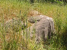
The Tasmanides also extended into Antarctica in the south and northern China in the north, as these continental units were attached to Australia at the time, in Gondwana.
During the Palaeozoic era at least a few thousand kilometres of the ocean floor were subducted, taking of the order of a hundred million years.
Towards the end of this period there were isolated parts where no turbidity currents reached and only fine clay and animal organic and silica debris were deposited into oxygen-depleted deep water.
The part of the oceanic plate attached to the continent was compressed, the suboceanic crust was severely shortened and thickened as well, giving rise to a duplex structure.
In the Canberra Graben and Cullarin Block, metamorphism mostly reached the upper greenschist stage, with shallow burial and temperature below 350 °C.
On the western margin in southwest Belconnen, Duffy, and Kambah in the Laidlaw and Walker Volcanics the temperature was lower and prehnite-pumpellyite facies was achieved.
In the east side of the Cullarin Block, in the east-pointing finger of the ACT, the Tabberabberan Orogeny also reached the upper greenschist facies again.
Minor mining operations have occurred historically throughout the region, both for precious metals including gold, silver, lead, and copper, and for construction materials.
Many minerals such as aurichalcite, bronchanite, caledonite, cerussite, hemimorphite, hydrozincite, linarite, native silver, rozenite, and zincsilite have been found at the location.
At Etheridge Creek, the type locality is a repeating pattern of sandstone, micaceous sandy shale, mudstone, black argillaceous and radiolarian chert.
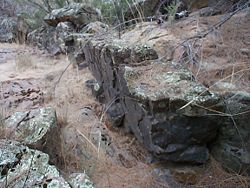
West of the Queanbeyan railway station is a cutting where folding has overturned the beds, with axes dipping to the east at 50 degrees.
Fossils found include Phyllograptus anna, Trigonograptus ensiformus, Pterograptus, Didymograptus, Isograptus, Hallograptus from the Darriwillian age.
Secondly the fine grained nature shows the sediments have been transported a long way from their ultimate, source, and could have been second cycle, derived from sedimentary rocks.
Upper beds contain Climacograptus bicornbis, Chastatus, C tubuliferis, Dicellograptus elegans, and Dicranograptus hians which are late Eastonian in age.
There are no fossils, but there is some sedimentary structure including plane, cross or convolute laminations, load casts, slump units and flute moulds.
[13] In addition to the ashstone the Canberra Formation has layers of green-grey to reddish dacite, also tuff, quartz andesite, but mostly it is calcareous shale, limestone or sandstone.
They occur in southern Belconnen including Macquarie, Weetangera, Hawker, Page, Scullin, Higgins, Holt and the Pinnacle.
The volcanics occur in northern Belconnen, in Dunlop, Fraser, Spence, Mount Rogers, Flynn, Melba and Hall.
The visible base shows a weathered repeating sequence of interbedded rhyodacitic ignimbrite, sandstone, siltstone and red and yellow shale.
A coarse green grey rhyodacitic intrusive outcrops over one square kilometre west of Holt in the Walker Volcanic sediments.
A coarse green grey rhyodacitic intrusive with white prominent feldspar crystals appears between the arms of Lake Ginninderra, McKellar, Evatt, Nine Elms, east Spence, and Nichols.
A coarse rhyodacitic intrusive outcrops to the north west of Charnwood intrudes Laidlaw Volcanics, with about half a square kilometre of surface area.
A distorted band of coarse grey rhyodacitic porphyry occurs along the Murrumbidgee River from 1 to 4 kilometres south of Point Hut Crossing.
Magnetic Field Components at Civic at the[24] end of 2013: The gravity anomaly over the ACT has been measured and published on the 1:100000 Canberra Geological Map.
High level points in the gravity field occur at the head of Yass River just north of the east finger of the ACT of –320 μm·s−2.
This means that a 50 kg person, if measured on a force scale rather than on a balance, would apparently weigh 1.3 grams more in Watson, than they would in western Kambah.