George Washington Memorial Parkway
It is located almost entirely in Northern Virginia, except for a short portion of the parkway northwest of the Arlington Memorial Bridge that passes over Columbia Island in Washington, D.C.
A third section, which is the Clara Barton Parkway, runs on the opposite side of the Potomac River in the District of Columbia and suburban Montgomery County, Maryland.
It also called for the construction of roundabouts at both the north and south ends of Washington Street as transition points between the rural and urban sections of the parkway.
It follows the Potomac River, passing through Arlington County, and serves as the primary access point to Ronald Reagan Washington National Airport.
The trip by DC area residents to see George Washington's family estate at Mount Vernon was seen in the late 19th and early 20th centuries as a patriotic duty as well as an opportunity to learn about American history and democratic values.
The United States Army Corps of Engineers conducted the survey, and in its report agreed that a superior, no-expense-spared road from Alexandria to Mount Vernon was necessary.
The McMillan Plan, however, focused not on a monumental avenue but on tree-lined boulevards and quiet carriage paths designed to relax and calm.
The agency hired Gilmore David Clarke and Jay Downer, who had designed the highly celebrated Central Westchester Parkway in New York, as consultants.
They quickly proposed a more elaborate system of plantings, historic roadside pullouts, and scenic overlooks, and a more sinuous road design.
The BPR began calling the road a "highway" rather than a parkway to de-emphasize its commemorative nature in the hope that Congress would fund its construction.
[18] During hearings in the House of Representatives on the issue, the American Civic Association, the National Council for the Protection of Roadside Beauty, and other groups testified that the existing roads to Mount Vernon were heavily lined with tawdry billboards, tourist traps, garish filling stations, and fast food joints.
[20] During House hearings in April 1924, the BPR drew attention to the poor condition of the existing roads, and their inability to handle more traffic.
Historic American Buildings Survey historian Sara Amy Leach has suggested that BPR's emphasis on an extremely wide right-of-way indicates that the agency was willing to abandon the inland, ridge-top route in favor of one along the Potomac River's edge.
The Washington Bicentennial Commission would oversee the project, with support from the United States Department of Agriculture with surveys, architectural and engineering plans, land acquisition, construction, etc.
Support for the Moore-Swanson bill also came from President Calvin Coolidge, the bicentennial commission, the US Senate, the Bureau of the Budget, the Daughters of the American Revolution, and the George Washington Masonic National Memorial Association.
Rep. Louis C. Cramton, leader of a coalition of interests that wanted to protect the Potomac River banks from any development, criticized the damage to the environment the highway would cause, the stuffy architectural designs, and the elaborate roadside attractions which had been proposed.
But Congress renamed it the George Washington Memorial Parkway in 1930, and authorized its extension to the "Great Falls of the Potomac River".
[34] The idea for a large George Washington Memorial Parkway came from Rep. Cramton, who introduced legislation in January 1929, to construct a larger system of roads and parks.
The Act appropriated $13.5 million to acquire land and build a Parkway on the Virginia southern shoreline from Mount Vernon to the Great Falls" (excluding the city of Alexandria), and to also build a parkway on the Maryland northern shoreline from Fort Washington, Maryland, to the Great Falls of the Potomac (excluding the District of Columbia).
[40] Due to a lack of lights, ongoing construction and poor connections on the Virginia side, the bridge and highway were only open during daylight hours on Saturday and Sunday.
[39] The portion of the parkway from Glebe Road to I-495, was built primarily to provide access for workers at the new Central Intelligence Agency headquarters in Langley, Virginia, in 1959.
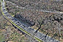
[44] The portion of the parkway just north of the Key Bridge was considered a model of modern highway design, and it was featured in many scholarly papers, engineering journals, and textbooks of the day.
[46] Over time, small additions were made to the parks and roads included in the larger areas administered by the George Washington Memorial Parkway.
It was signed and designated as the George Washington Memorial Parkway until 1989, when it was renamed to overcome motorist confusion with the main segment in Virginia.
Some elements of the proposed final parkway configuration—such as the concrete bridge that would have carried northbound traffic at the Glen Echo turn-around—were built but have never been used.