Gisborne, New Zealand
[6] East Coast oral traditions offer differing versions of Gisborne's establishment by Māori.
[10] Māori historian Rongowhakaata Halbert affirmed this account, stating that Paoa's crew on the Horouta were the first inhabitants of the East Coast after migrating from Ahuahu or Great Mercury Island.
[8] Gisborne's Kaiti Beach is the place where British navigator Captain James Cook made his first landing in New Zealand upon the Endeavour.
Once he had concluded his duties in Tahiti, Cook continued south to look for a large landmass or continent, before heading west.
[15] On 9 October, Cook came ashore on the eastern bank of the Tūranganui River, accompanied by a party of men.
[14][17] In 2019, a memorial was erected by Ngāti Oneone on Titirangi, a local hill, to honour Te Maro, who was one of the first casualties of the arrival of the ship Endeavour.
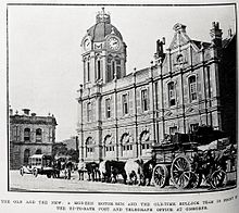
The town was laid out in 1870 and the name changed from Turanga to Gisborne, after the then colonial secretary, and to avoid confusion with Tauranga.
In 1872, Gisborne's first public school was opened and its first newspaper, the Poverty Bay Standard was established.
The Poverty Bay flats encompass Gisborne city as well as surrounding areas Mākaraka, Matawhero and Ormond, where vineyards and farms predominate.
[20] Gisborne boasts a large stretch of coastline encompassing the Waikanae and Midway, Kaiti, Sponge Bay, Wainui and Makorori white sand beaches, which are popular for swimming and surfing.
[23] Kaiti Hill (Titirangi), which sits directly above Cook's landing site,[24] provides expansive views over the city and wider Poverty Bay.
[27][28] Until Samoa and Tokelau's dateline shift in December 2011, Gisborne claimed to be the first city on Earth to see the sun rise each day.
[32] According to the NIWA dataset for 1981–2010 normals, Gisborne narrowly edged several other New Zealand cities to have the warmest summer maxima of official stations.
[33] Winters are slightly cooler than more northerly areas, rendering that over the course of the calendar year, Gisborne is not the warmest station in the country.
In February 2018, the first grants from the Provincial Growth Fund included $2.3 million for the Gisborne port.
For 25 years Sunair operated from Gisborne to Hamilton, Rotorua, Napier, Whakatāne, Tauranga, Palmerston North, Paraparaumu and Wellington but those services were suspended in 2022.
[45] State Highway 2 connects Gisborne to Tauranga via Ōpōtiki and Whakatāne to the northwest, and to Napier and the rest of Hawke's Bay via Wairoa to the south.
It then crosses the Waipaoa River and makes its way south through Manutuke and Wharerata before it enters the Hawke's Bay Region towards Nūhaka, Wairoa, and eventually on to Napier.
The permanent way has since suffered storm damage including bridge collapses and the line is believed unlikely to re-open for economic reasons.
Rail passenger services were provided between Gisborne and Wellington until 1988, when the Endeavour express was cancelled north of Napier.
[52] Gisborne is host to Rhythm & Vines, an annual 3-day music festival held over the New Year at Waiohika Estate.
Gisborne is home to the Poverty Bay cricket team, who compete in the Hawke Cup.
Clubs include Horouta, High School Old Girls (HSOG), Old Boys Marist (OBM), Young Māori Party (YMP), and Gisborne Thistle.
[55] The track races various types of cars, including sidecars, midgets, saloons, stockcars, streetstocks, in addition to motorcycle speedway.
[61] In March 2016, Gisborne hosted the premiere of Mahana, a New Zealand film set in Patutahi and Manutuke, and based on Witi Ihimaera's semi-autobiographical novel Bulibasha: King Of The Gypsies.