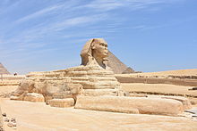
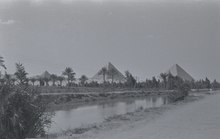
Giza Plateau
The Arab historian al-Maqrīzī, writing in the 15th century, attributes the loss of the nose to Muhammad Sa'im al-Dahr.
The archaeological evidence suggests that it was created by ancient Egyptians of the Old Kingdom during the reign of Khafre (c. 2558–2532 BC).
Dominating the plateau and running in a southwest diagonal through the site are the three pyramids of the pharaohs Khufu, Khafre, and Menkaure.
The Giza Plateau Mapping Project (GPMP) was undertaken in 1984, "an effort to better understand the social and economic forces that supported pyramid construction.
"[6] Mark Lehner and his team produced an accurate map of the natural and cultural features of the entire Giza Plateau.