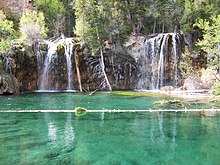
Glenwood Canyon
The canyon stretches from near Dotsero, where the Colorado receives the Eagle River, downstream in a west-southwest direction to just east of Glenwood Springs, on the mouth of the Roaring Fork.
The canyon was formed relatively recently in Pleistocene time by the rapid cutting of the Colorado down through layers of sedimentary rock.
The Mississippian layer that is prominent throughout much of the upper rim sections of the canyon is part of the Leadville Formation.
The canyon also provided the route for the Denver and Rio Grande Western Railroad in the late 19th century.
[1][2] The canyon is widely considered one of the most scenic natural features on the Interstate Highway System of the United States.