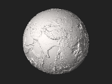
Global relief model
Global relief models are always based on combinations of data sets from different remote sensing techniques.
Elevation data over land is often obtained from LIDAR or inSAR measurements, while bathymetry is acquired based on SONAR and altimetry.
Global relief models may also contain elevations of the bedrock (sub-ice-topography) below the ice shields of Antarctica and Greenland.
Although grid cells are spaced at 15 or 30 arc-seconds, when SONAR measurements are unavailable, the resolution is much worse (~20-12 km) depending on factors such as water depth.
It supports applications such as tsunami forecasting, ocean circulation modeling, and Earth visualization.
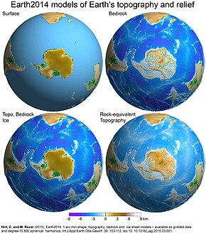
[2]The Earth2014 global relief model,[3] developed at Curtin University (Western Australia) and TU Munich (Germany).
Earth2014 provides sets of 1 arc-min resolution global grids (about 1.8 km postings) of Earth's relief in different representations based on the 2013 releases of bedrock and ice-sheet data over Antarctica (Bedmap2) and Greenland (Greenland Bedrock Topography), the 2013 SRTM_30PLUS bathymetry and 2008 SRTM V4.1 SRTM land topography.