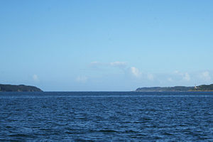
Goulet de Brest
At each turn of the tide, the ocean refills the roadstead in a current that can attain 4 to 5 knots.
[1] Sailing ships would thus wait in the cove of Camaret-sur-Mer for a favourable current to carry them into the goulet.
Consequently, successive French governments have lined the goulet with military installations to protect the town and the naval fleet based there, and to keep a watch on shipping using it.
The geography of the goulet favours the defenders, as it has a spine down its length, in the form of the Le Mengant rocks, which force ships to sail either to their north or south.
[1] The body of water is surrounded by these areas and sites (nearby or at a moderate distance):