Maryland Route 2
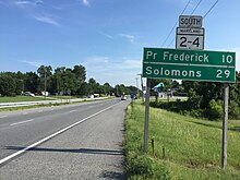
The route runs concurrent with MD 4 through much of Calvert County along a four-lane divided highway known as Solomons Island Road, passing through rural areas as well as the communities of Lusby, Port Republic, Prince Frederick, and Huntingtown.
MD 2 serves as a north–south route located a short distance to the west of the Chesapeake Bay in Calvert and Anne Arundel counties and in the city of Baltimore in Maryland.
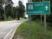
In Calvert County, the route runs through mostly rural areas, passing through the communities of Solomons Island, Lusby, Port Republic, Prince Frederick, Huntingtown, Sunderland, and Owings.
MD 2/MD 4 narrows back to four lanes as it passes more businesses as well as the Calvert Health Medical Center east of the road before heading into areas of farms, woods, and residences.
[1][3] Shortly after splitting from MD 4, the route intersects the eastern terminus of MD 262 (Lower Marlboro Road) before passing east of a park and ride lot serving MTA Maryland commuter buses and heading into woodland with areas of residences and businesses.
[1] The road heads through wooded areas, narrowing to six lanes, before coming to an interchange with MD 70 (Rowe Boulevard).
[1][3] The route passes under MD 436 (Ridgely Avenue) and runs near residential neighborhoods before crossing over the Severn River on the Pearl Harbor Memorial Bridge.
It passes more businesses before coming to an exit and southbound entrance with a spur of I-895 (I-895B) that provides access to and from I-97, westbound I-695, and I-895.
[3] In Anne Arundel County, the daily traffic counts on MD 2 range from a high of 121,851 vehicles at the west end of the concurrency with the John Hanson Highway in Annapolis to a low of 14,192 vehicles at the intersection with MD 258 in the southern part of the county in 2007.
[2] The route heads through urban residential and commercial areas in the Brooklyn neighborhood, intersecting MD 173 (Patapsco Avenue).
[2] It crosses over the Middle Branch on the Hanover Street Bridge and continues north through industrial areas.
[6] Past the I-95 interchange, MD 2 heads through the Federal Hill neighborhood through areas of rowhouses as a two-lane street.
It comes to a partial interchange with I-83 (Jones Falls Expressway), consisting of a ramp from southbound I-83 to southbound MD 2, and crosses over Amtrak's Northeast Corridor railroad line adjacent to Penn Station serving Amtrak and MARC's Penn Line.
[3] Past the train station, MD 2 intersects the southern terminus of MD 25, which follows a one-way pair along eastbound Lanvale Street (carrying the southbound direction) and westbound Lafayette Avenue (carrying the northbound direction), before it comes to its northern terminus at US 1 and US 40 Truck (North Avenue).
[7] The highway was graded and surfaced as an improved dirt road from Owings south to Hunting Creek in 1910 and 1911 and from there to Prince Frederick between 1911 and 1913.
The newly formed Maryland State Roads Commission was placed in charge of constructing the new Baltimore–Annapolis Boulevard.
[9] The boulevard was constructed as a 16-foot (4.9 m) wide macadam road from the Severn River north to Arnold and from Severna Park to Pasadena in 1910 and 1911.
[13] Unrelated to the Baltimore–Annapolis Boulevard, the commission constructed a 14-to-18-foot (4.3 to 5.5 m) wide macadam road from Glen Burnie to Brooklyn, which was then in Anne Arundel County, in 1915.
In Brooklyn, the new highway connected with the south end of the Light Street Bridge that crossed the Patapsco River into Baltimore.
MD 2 passed through downtown Annapolis on College Avenue and King George Street before it left the city on the Severn River Bridge and continued north along Baltimore–Annapolis Boulevard to Glen Burnie.
[15] In 1930, a concrete cut-off was built in Glen Burnie that allowed MD 2 traffic to bypass the community's central intersection to the northeast.
[17] The first portion of Governor Ritchie Highway was completed as a four-lane divided upgrade to existing MD 2 from the Baltimore city limit in Brooklyn Park to Furnace Branch in 1934 and 1935.
[17] Construction on the remainder of Governor Ritchie Highway began in 1936 and was completed south from Furnace Branch to the Severn River in 1938.
[21] Throughout the mid 20th-century, a commercial district developed along MD 2 in Glen Burnie, which included several car dealerships and the Harundale Mall.
[24] The MD 2 reconstruction continued south a few miles to the northern end of Lusby in 1942, a stretch widened to 22 feet (6.7 m) and resurfaced with bituminous stabilized gravel.
[28] This improvement occurred contemporaneously with or shortly before the construction of the Prince Frederick bypass; MD 2 moved to the new 24-foot (7.3 m) wide bituminous stabilized gravel highway in the autumn of 1951.
[29] MD 2 from Owings to Edgewater starting receiving its first major upgrades in the 1950s, including several relocations of the highway.
The highway from Edgewater south to Harwood (then known as Butlers) was widened and resurfaced with bituminous stabilized gravel in 1950 and 1951.
[41] In January 1978, MD 4 was rerouted north of Solomons onto the Governor Thomas Johnson Bridge over the Patuxent River.
[6] The road was laid out to a width of 160 feet (50 m) from Light Street to Locust Point in the early 1910s, providing better access to the new city-owned piers in preparation for increased trade via the Panama Canal and existing steamship lines to Europe.