Grant County, Oregon
[2] It is named for President Ulysses S. Grant,[3] who served as an army officer in the Oregon Territory, and at the time of the county's creation was a Union general in the American Civil War.
The great distance to The Dalles made law enforcement a difficult problem, and imposed a heavy burden on citizens who had a need to transact business at the courthouse.
[4] After gold was discovered in 1862 on Whiskey Flat, it has been estimated that within ten days 1,000 miners were camped along Canyon Creek.
Mining and ranching, along with timber and then the service and public works that followed, brought people into the area and communities grew around the natural centers of industry and agriculture.
Canyon City hosts an annual summer festival called "'62 Days" (referencing the local gold discovery in 1862) to celebrate its history and residents.
Since the 1930s, the city of John Day has served as the main economic center of the county, and boasts the largest population.
The elevation of the county varies from 1,820 on the John Day River near Kimberly, to 9,038 feet (2,755 m) at the summit of Strawberry Mountain.
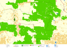
The terrain of the county varies from grassland steppes and rangelands in relatively open or rolling hills and valleys, to steep, rugged, rocky high-alpine landscapes.
Travelers and emigrants of the 19th century remarked that the absences of underbrush, and the wide spacing of the trees, made it possible to drive a wagon and team of horses virtually anywhere the grade would permit.
Cottonwoods grow along some rivers and streams, and there are small groves of birch and Quaking Aspen at higher elevations.
Other flora includes a wide variety of native grasses and wildflowers, huckleberries, wild strawberries, elderberries, several types of edible mushrooms and Oregon-grape, the state plant.
During the Cenozoic Era, volcanic activity and extensive lava flows in the region dramatically changed the landscape.
The John Day Fault (one of the only major faults in North America to run east–west) runs along the southern edge of the John Day Valley, caused an uplift, forming the Strawberry and Aldrich mountain ranges and the northern boundary of the Great Basin.
Relatively recently in geological terms, during the last Ice age and shortly thereafter, large lakes were present in southeastern Oregon.
Valuable metals, including gold, silver, platinum group elements, chrome, copper and cobalt, are found in the region.
Large zones of serpentine, a metamorphic rock, dating from the Triassic period, are found in numerous locations.
The remnants of ferns, semi-tropical and temperate deciduous forests, shellfish, saber-toothed cats, extinct horse and camel species, and giant sloth, among other extinct species found in the John Day Fossil Beds, are a reminder that the flora and fauna of the region has changed significantly over the millennia.
While deer, elk, pronghorn, cougar, bear and upland game bird populations thrive today, some of these animals were remarkably scarce 200 years ago.
Explorers and trappers traveling through the region in the early 19th century remarked on the scarcity of game animals and their ability (or inability, as the case were) to find food.
While salmon and steelhead returns to the John Day Basin experienced a sharp decline during the past 50 years, mainly due to the construction of large dams on the Columbia River, the major watercourses of John Day Basin remain free of physical obstructions, and the numbers of returning salmon and steelhead have improved in recent years, marking some of the best fish runs recorded in the past half-century.
This snow pack is vital to recharge aquifers, resulting in spring run-off, and in-stream flows of water throughout the year.
Extreme temperatures in the county show 30-year highs/lows of: 103°/-37 °F at Austin; 112°/-23 °F at John Day; 108°/-25 °F at Long Creek; 112°/-26 °F at Monument; and 100°/-48 °F at Seneca.
These people were employed as follows: 56.9% private wage/salaried positions; 14.7% private self-employed (not incorporated business); 0.8% private unpaid family workers; 27.6% public employees (municipal, county, state, federal governments); By industry: 20.6% education, health, social services; 17.3% agriculture, forestry, mining; 10.0% manufacturing; 9.8% retail trade; 7.6% arts, entertainment, recreation, accommodations, and food; 6.9% public administration; 6.5% construction; 5.9% other services; 5.1% transportation, warehousing, utilities; 4.1% professional, administrative, and waste management; 3.1% finance, insurance, real estate, leasing; 1.7% information; 1.5% wholesale trade; Like the other counties in eastern Oregon, the majority of registered voters who are affiliated with a political party in Grant County are members of the Republican Party.
In the 2020 election, the county had shifted back to the Republican candidate Donald Trump, who received 77.28% of the votes, compared to Joe Biden's share of 20.17%.
Livestock raising and timber harvesting remain important sectors of Grant County's economy, although the production and profitability of these industries has declined in recent years due mainly to political and expanding-market factors.
Due mainly to federal land management policies and global market pressures affecting timber and agricultural production and extraction, the county has experienced the second highest unemployment rate in Oregon for more than 30 years.