Great Eastern Highway
Great Southern Highway begins near Perth's eastern metropolitan boundary, linking towns such as York, Brookton, Narrogin, and Katanning.
Over the years the road has been upgraded, with the whole highway sealed by 1953, segments reconstructed and widened, dual carriageways created in Perth and Kalgoorlie, and grade separated interchanges built at major intersections.
A future route to replace Great Eastern Highway's current ascent of the Darling Scarp has been planned and named EastLink WA.
Travelling north-east through the city to Greenmount Hill, and following a steep climb, the highway heads east through Western Australia's Wheatbelt to Kalgoorlie, in the state's Goldfields.
From the eastern edge of Perth it is generally 110 km/h (70 mph), but with lower limits for sections near the towns the highway encounters en route to Kalgoorlie.
It proceeds in a north-easterly direction between local parks for 1.3 kilometres (0.8 mi), south of the Crown Perth entertainment complex in Burswood.
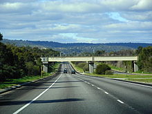
After passing under the Armadale line, there is a diamond interchange with Graham Farmer Freeway to the north-west and Orrong Road to the south-east, with an additional south-westbound to north-westbound looped ramp.
The highway continues north-east, parallel to the Swan River, through the residential and commercial areas of Rivervale, Belmont, Ascot, and Redcliffe.
The road travels for another 2.1 kilometres (1.3 mi) along the border between Ascot and Redcliffe, before reaching a traffic light controlled fork with Great Eastern Highway Bypass.
The highway crosses the Helena River via a two-lane bridge, and continues north into the historic townsite of Guildford, named as Johnson Street.
Following a level crossing of the railway, and an adjacent set of traffic lights at Terrace Road, the name Great Eastern Highway is resumed.
At a 2019 Belmont council meeting interstate town planners attended and mentioned that with 60,000 to 80,000 vehicles a day in the section west or Roe Hwy they could not find a busier "road" (not Highway or Freeway) in the world.
The historic hill, with significant Aboriginal and European heritage sites, has been a well-known landmark since the 1830s, and featured on an 1846 survey of the York Road.
It continues east for six kilometres (3.7 mi) between the low-density, rural residential areas of Hovea, Mahogany Creek, and Parkerville, before entering the Mundaring town centre.
[17] Beyond Sawyers Valley, Great Eastern Highway travels in a north-easterly direction, alongside and later within the northernmost part of the Jarrahdale State Forest.
The highway then heads in a north-easterly direction, passing to the south of Wundowie, through Bakers Hill, and reaching Clackline after 20 kilometres (12 mi).
The highway takes an 11.7-kilometre (7.3 mi) curve around the northern edge of Northam, meeting up with the eastern section of the former alignment, known as Yilgarn Avenue.
The road passes by agricultural land and remnant native vegetation, intermittently encountering small settlements and towns such as Meckering, Cunderdin, Kellerberrin, and Merredin.
The landscape changes to low shrubland, with few signs of human activity other than the highway itself, and the mostly parallel water pipeline and power line.
Great Eastern Highway, now signposted as Alternate National Route 94, turns north-east, travelling through another 32 kilometres (20 mi) of scrubland to the outskirts of Kalgoorlie.
The department refused the request, reasoning that most traffic bound for Midland used The Causeway and travelled on the south side of the Swan River, and that therefore the Perth–Guildford road should not be part of the main highway.
The issue was considered important, as losing the name to the south side of the river would divert traffic away from the old established centres to the north.
[38][39] The conference, held on 7 September 1934, was attended by representatives of the Perth, Bayswater, Bassendean, and Guildford road boards, and the Midland Junction Council.
[41][42] This created a "peculiar situation", as described by the RAC, with roads both north and south of the Swan River proposed to be renamed as Great Eastern Highway.
Despite the name change not being official, some residents along the road through Belmont started describing their properties as located on Great Eastern Highway.
[44] The northern route was also shorter by about two miles (3.2 km), and considered by the local governments to be the "natural entrance to the city", only crossing the Swan River once and not again at the Causeway.
[45] On 8 January 1935, representatives from the local governments north of the river urged Minister for Lands, Michael Troy, to rename the Perth–Guildford road through those areas as Great Eastern Highway.
[50] In 1994, the federal government approved a $43.9 million project to upgrade substandard sections of Great Eastern Highway between Northam and Southern Cross.
The 5.6-kilometre (3.5 mi) bypass branches off the original highway alignment at South Guildford, proceeds around the northern edge of Perth Airport, and then heads east through Hazelmere.
[67] A bypass of Clackline was also constructed, realigning 1.5 kilometres (0.93 mi) of Great Eastern Highway 100 metres (330 ft) north of the town.