Greater Bristol
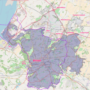
[1] This covers the contiguous built-up area around Bristol, including the towns and villages of Kingswood, Mangotsfield, Stoke Gifford, Bradley Stoke, Patchway, Filton, Almondsbury, Frampton Cotterell and Winterbourne in South Gloucestershire; Pill, Leigh Woods and Easton-in-Gordano within North Somerset; and part of Whitchurch which falls within the administrative area of Bath and North East Somerset.
However, this ONS definition does not include the city of Bath, or the towns of Yate, Keynsham, Portishead, Clevedon or Weston-super-Mare.
[2] The ONS give a figure for the population of the Bristol Urban Area of 617,280,[3] making it the eleventh largest conurbation in England and Wales.
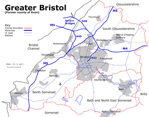
The urban area is subdivided into the following: The wider "Greater Bristol" area – that is, the former Avon county area – has since 1996 been divided for local government purposes between Bristol City Council, and Bath and North East Somerset, North Somerset, and South Gloucestershire councils, and is shown on the map on this page.
[5] Other alternative names occasionally in official use for the former Avon area include the West of England and Severnside.