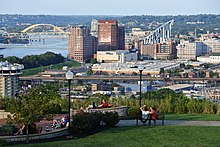
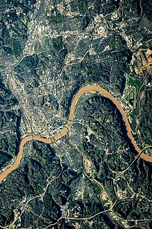
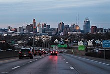
Cincinnati metropolitan area
[4][5] Its largest city is Cincinnati and includes surrounding counties in the U.S. states of Ohio, Kentucky, and Indiana.
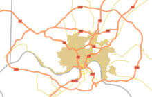
Newly defined MSAs (Metropolitan) and μSAs (Micropolitan) Statistical Areas are CBSAs.
From 2005 to 2013, the Cincinnati–Middletown–Wilmington CSA included the Cincinnati–Middletown MSA (defined as the old Cincinnati–Hamilton–Middletown CMSA), and Wilmington, OH μSA (Clinton County, Ohio).
[9] Most of the region's population growth has occurred in the northern counties, leading to speculation that the Cincinnati–Northern Kentucky metropolitan area will eventually merge with Greater Dayton.
[10] Cincinnati is also located very close to other metropolitan areas, such as Columbus, Indianapolis, Lexington, and Louisville.
The southern area of the region, from roughly about the Ohio River, is at the extreme northern limit of the humid subtropical climate; the north part of the region is on the extreme southern cusp of the humid continental climate.
Most noticeable are the Southern Magnolia and Mimosa trees, and the needle palm also may be found as a winter hardy landscape specimen in lawns near the Ohio River.
Although widely accepted as part of the very southern fringe of the Midwestern United States in most cases, the Cincinnati–Northern Kentucky metropolitan area is climatically and geographically located on the northern periphery of the Upland South region of the United States and is within the Bluegrass region of Ohio and Kentucky in the Upper South.
[20][21] Amtrak's Cardinal makes three weekly trips in each direction between Chicago and New York City through Cincinnati Union Terminal.
The airport is one of DHL Aviation's three superhubs, offering non-stop passenger service to over 50 destinations in North America and Europe.