HP postcode area
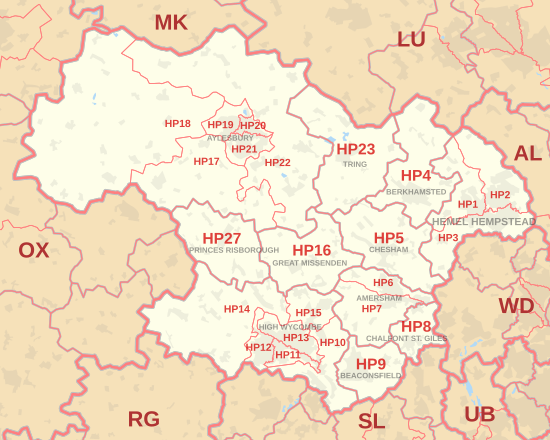
The HP postcode area, also known as the Hemel Hempstead postcode area,[2] is a group of twenty-four postcode districts in England, within eleven post towns.
These cover south-west Hertfordshire (including Hemel Hempstead, Berkhamsted and Tring) and central Buckinghamshire (including Aylesbury, High Wycombe, Beaconsfield, Amersham, Chalfont St Giles, Chesham, Great Missenden and Princes Risborough).
Mail for this area is sorted at the Home Counties North Mail Centre in Hemel Hempstead.
The approximate coverage of the postcode districts: