Hamburg Wallring
The Wallring (German pronunciation: [ˈvalrɪŋ]) is a semi-circular urban ensemble encircling the inner city of Hamburg.
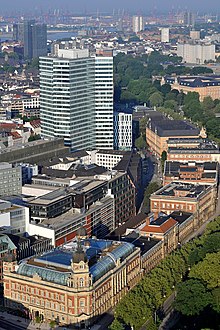
It consists of a four-lane ring road with a total length of 3.3 kilometers (2.1 mi) and a continuous built-up street front on its inner side.
The Wallring park consists of several differently named sections, which — based on their common historical development — are characterized by a certain unity, but also by a number of dissimilarities.
It also offers the inner city's largest network of parks, and forms a sort of connection to Hamburg's green and open spaces along Elbe and Alster.
The Wallring follows the course of Hamburg's former Wallanlagen (ramparts) developed by Dutch military engineer Johan van Valckenburgh between 1616 and 1625.
The fortifications were ultimately removed between 1820 and 1837, the outer glacis were subsequently remodeled into a park by German landscape architect Isaak Altmann (1777–1837).
Holstenwall, the Wallring's first section, runs up to Johannes-Brahms-Platz, named after Hamburg-born composer Johannes Brahms, and location of the Laeiszhalle.
The Esplanade (German pronunciation: [ˌɛsplaˈnaːdə]) is only 0.25 kilometers (0.16 mi) long, yet at 50 meters (160 ft) rather wide.
It runs from Stephansplatz to the north-western corner of Binnenalster and was developed between 1827 and 1830 according to plans by Carl Ludwig Wimmel (1786–1845).
On the bridge, the view opens up wide onto the Binnenalster, historically the Hanseatic city's "state parlour".
Despite this concentration of art, its outer perimeter is lacking the ring road's overriding underlying concept of a unified spatial perception and subject to redevelopment.


At Lombard Bridge, the ring road crosses the Alster River. The eastern Wallring continues on the inside of the railway tracks , before terminating at the Elbe's shore at Oberhafen.


