Harlem Line
It is the only Metro-North line used exclusively by that carrier (no use by Amtrak, though CSX services freight customers as far north as Mount Vernon) and the only one that uses the entirety of existing track.
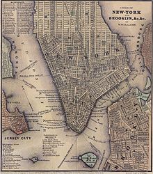
[4]: 1 [5][6] The Harlem Line hews closely to roads along river-based transportation corridors dating back to even pre-rail times.
The lines then parallel the western edge of Fordham University until the Botanical Garden station at Bedford Park Boulevard (200th Street).
Rail and road briefly separate at Mount Kisco, but then remain close by at the last stop along the Saw Mill, Bedford Hills (although the parkway cannot be seen from the station).
After Croton Falls, the Harlem Line runs along East Branch Reservoir and crosses into Putnam County and its rural landscape.
[7] The track finally follows its own course, away from any road or river, past the former Dykemans and abandoned Towners stations up to Patterson and into Dutchess County.
Shortly before reaching Pawling, the line enters the Harlem Valley (which takes its name from the railroad) and begins to parallel Route 22, although not as closely as it did the roads further south.
[9]: 4 On April 27, 1837, an act was passed in the State Legislature to widen Fourth Avenue between 32nd Street and the Harlem River to provide room for the railroad.
The deal was completed on February 28, 1840, and on May 7, 1840, the New York State Legislature granted the Harlem the right to extend into Westchester County, which at the time included what is now The Bronx.
[25] In 1875, the line was grade-separated and put in an open cut and a viaduct between Grand Central and the Harlem River to reduce the loss of life and to increase speeds.
[26] On May 15, 1876, partial rapid transit began on the Harlem Line, with sixteen trains a day running between Grand Central Depot and William's Bridge.
[33] As part of the project, the line north of 106th Street to the Harlem River was elevated so that it could reach the height of the new four-track drawbridge: the only one in the country at the time.
Other improvements were made to the Harlem Division at the same time: grade crossings were being eliminated, tracks were being straightened and new stations were built at White Plains and Mount Vernon.
[55] At the end of World War II, private rail service began a sharp decline with the start of the Jet Age in 1958 and the construction of the Interstate Highway System.
[56]: 177 NYC, facing declining year-over-year profits, merged in 1968 with its former rival, the Pennsylvania Railroad, forming the Penn Central Transportation Company.
[59] However, this approval was denied, and the denial was affirmed in Penn Central Transportation Co. v. New York City, a 1978 decision by the United States Supreme Court.
The cutback of service to Chatham was strongly opposed by the Harlem Valley Transportation Association, which was led by Lettie Gay Carson.
In 1989, New York State purchased 21 miles (34 km) of the right-of-way between Wassaic and Copake Falls for the development of the Harlem Valley Rail Trail.
[71] On March 15, 1975, these cars started stopping at the Melrose, Tremont, Fordham, Botanical Garden, Williamsbridge, Woodlawn and Wakefield stations on the Harlem Line with the partial completion of their high-level platforms.
In 1976, the MTA undertook a study on the existing traction power system and it identified extending electric service to Brewster as a priority.
[73] For an additional $45 million, high-level platforms were installed to reduce dwell times, and electric substations were built to supply the power needed for third-rail operation.
[4]: 1–9 On April 14, 1986, the MTA released a study on the future of the non-electrified section of the Harlem Line between Brewster North and Dover Plains.
[79] The decision was strongly opposed by Bronx Borough President Fernando Ferrer, who said that the agency created a self-fulfilling prophecy by failing to promote the station and by not maintaining it.
The extension was intended to help revive the community of Wassaic, and to turn it into a hub where passengers would come from Litchfield County in Connecticut, the Berkshires in Massachusetts, and from Vermont.
[96][97] In fact, since 1984, weekday ridership on trains to Dover Plains increased by 463 percent to a total of 535 people riding south daily.
[99] Early in 1994, Metro-North announced plans to build a third track along 2.5 miles (4.0 km) of the Harlem Line between Mount Vernon West and Crestwood to increase capacity and to eliminate a bottleneck.
[104] On November 13, 2018, the MTA announced its intent to purchase the Hudson and Harlem Lines as well as the Grand Central Terminal for up to $35.065 million, plus a discount rate of 6.25%.
[113] In the 2015–2034 MTA Twenty-Year Capital Needs Assessment, two possible Harlem Line projects that would provide capacity to deal with increasing ridership and to expand service are mentioned.
Under New York Central ownership, it previously operated a 7.22 mi (11.62 km) branch to Lake Mahopac to a connection with the Putnam Division.
[122] After the construction of the Oak Point Link at the Bronx's southern tip[123] and its subsequent opening in 1998,[124] trains stopped operating along the Port Morris Branch in 1999.