Hastings, Minnesota
[7] The advantages of Hastings's location that led to its original growth are that it is well-drained, provides a good riverboat port, and is close to a hydropower resource at the falls of the Vermillion River.
In the winter of 1820, a military detachment from Fort Snelling settled the area around Hastings to guard a blocked shipment of supplies.
[8] After the Treaty of Mendota of 1851 opened the area for white settlement, Oliver's Grove was surveyed and incorporated as a city in 1857, a year before Minnesota's admission to the Union.
[9] In the mid-19th century, Hastings, Prescott, Wisconsin, and the adjacent township of Nininger were areas of tremendous land speculation.
The speculation and panic caused the cities' growth to be less than expected given their location at the confluence of two significant rivers; today, their combined population is approximately 25,000, and all that remains of Nininger is a few building ruins.
The county administration began moving to a new facility in 1974, and in 1989 the City of Hastings purchased the old building.
In 1895 a spiral bridge was built over the Mississippi River, designed to slow down horse-drawn traffic as it entered downtown.
2 at Hastings, part of the canal lock systems on the Mississippi that stretch from Minneapolis to St. Louis.
2 is the site of the nation's first commercial, federally licensed hydrokinetic power facility, a partnership between the City of Hastings and Hydro Green Energy, LLC of Westmont, Illinois.
Fasbender Clinic, designed by Frank Lloyd Wright, is a city landmark.
In 1867 civic leaders William LeDuc, John Meloy, Stephen Gardner, E. D. Allen, and P. Van Auken—with financial backing from investors John B Alley, Oliver Ames, William Ames and Peter Butler—incorporated the Hastings & Dakota Railway with the goal to "cross the Rocky Mountains and meet the Pacific Ocean".
In 1882 the Milwaukee Road gained control of the S&H and operated it as a profitable branch line.
The north H&D district remains intact from Minneapolis to Ortonville—except for the Lake Street Depression—and is operated by the Twin Cities & Western Railroad from Minneapolis to Hanley Falls and by BNSF Railway between Hanley Falls and Ortonville.
Canadian Pacific Railway now operates the former Milwaukee mainline through town as well as the Ardent Mills spur.
Bluffs lie along the northern shore of the Mississippi and there is a gorge surrounding the Vermillion below the falls.
Amtrak trains pass through, but do not stop in Hastings (passengers must go to St. Paul or Red Wing to board).
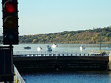
The Mississippi River is a major thoroughfare for barges, which are helped upstream by Lock and Dam No.