HiRISE
The 65 kg (143 lb), US$40 million instrument was built under the direction of the University of Arizona's Lunar and Planetary Laboratory by Ball Aerospace & Technologies Corp.
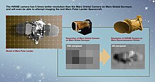
It consists of a 0.5 m (19.7 in) aperture reflecting telescope, the largest so far of any deep space mission, which allows it to take pictures of Mars with resolutions of 0.3 m/pixel (1 ft/pixel), resolving objects below a meter across.
[1] In the late 1980s, Alan Delamere of Ball Aerospace & Technologies began planning the kind of high-resolution imaging needed to support sample return and surface exploration of Mars.
In early 2001 he teamed up with Alfred McEwen of the University of Arizona to propose such a camera for the Mars Reconnaissance Orbiter (MRO), and NASA formally accepted it November 9, 2001.
Ball Aerospace was given the responsibility to build the camera and they delivered HiRISE to NASA on December 6, 2004 for integration with the rest of the spacecraft.
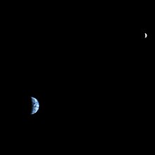
During the cruise phase of MRO, HiRISE took multiple test shots including several of the Moon and the Jewel Box cluster.
On March 10, 2006, MRO achieved Martian orbit and primed HiRISE to acquire some initial images of Mars.
[2] The instrument had two opportunities to take pictures of Mars (the first was on March 24, 2006) before MRO entered aerobraking, during which time the camera was turned off for six months.
[6] Subsequent experiments with the Engineering Model (EM) at Ball Aerospace provided definitive evidence for the cause: contamination in the analog-to-digital converters (ADCs) which results in flipping bits to create the apparent noise or bad data in the images, combined with design flaws leading to delivery of poor analog waveforms to the ADCs.
[13] On April 1, 2010, NASA released the first images under the HiWish program in which the public suggested places for HiRISE to photograph.
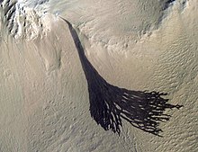
[17] It has provided a closer look at fresh Martian craters, revealing alluvial fans, viscous flow features and ponded regions of pitted materials containing breccia clast.
HiRISE's onboard computer reads out these lines in time with the orbiter's ground speed, meaning the images are potentially unlimited in height.
[24][25] To facilitate the mapping of potential landing sites, HiRISE can produce stereo pairs of images from which the topography can be measured to an accuracy of 0.25 meter.
HiRISE images are available to the public, are named according to the following rules:[27] The target code refers to the latitudinal position of the center of the planned observation relative to the start of orbit.