Mars Global Surveyor
Mars Global Surveyor (MGS) was an American robotic space probe developed by NASA's Jet Propulsion Laboratory and launched November 1996.
[3] MGS remains in a stable near-polar circular orbit at about 450 km altitude and as of 1996, was expected to crash onto the surface of the planet in 2050.
Several days passed before a faint signal was received indicating that the spacecraft had entered safe mode and was awaiting further instructions.
However, based on the vast amount of valuable science data returned, NASA extended the mission three times.
[4] The spacecraft, fabricated at the Lockheed Martin Astronautics plant in Denver, is a rectangular-shaped box with wing-like projections (solar panels) extending from opposite sides.
In order to achieve the near-circular orbit required for the mission while conserving propellant, the team designed a series of aerobraking maneuvers.
About one month into the mission, it was discovered that air pressure from the planet's atmosphere caused one of the spacecraft's two solar panels to bend backwards.
The panel in question had incurred a small amount of damage shortly after launch, the extent of which did not become apparent until subjected to atmospheric forces.
[8] From May to November 1998, aerobraking was temporarily suspended to allow the orbit to drift into the proper position with respect to the Sun and enable optimal use of the solar panels.
In the desired orientation for mapping operations, the spacecraft always crossed the day-side equator at 14:00 (local Mars time) moving from south to north.
The altitude was chosen to make the orbit Sun-synchronous, so that all images that were taken by the spacecraft of the same surface features on different dates were taken under identical lighting conditions.
This was called a CPROTO (Compensation Pitch Roll Targeting Opportunity), and allowed for some very high resolution imaging by the onboard MOC (Mars Orbiting Camera).
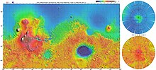
[20] After analyzing hundreds of high-resolution pictures of the Martian surface taken by the spacecraft, a team of researchers found that weathering and winds on the planet create landforms, especially sand dunes, remarkably similar to those in some deserts on Earth.
[21] On 6 December 2006 NASA released photos of two craters in Terra Sirenum and Centauri Montes which appear to show the presence of flowing water on Mars at some point between 1999 and 2001.