Ontario Highway 8
These early trails served as the principal routes in the regions through which they passed and eventually became part of the provincial highway system circa 1918.
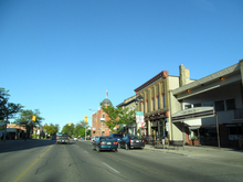
Portions of the highway through Goderich, Clinton, Seaforth, Mitchell and Stratford are locally-maintained under a Connecting Link Agreement with the provincial government.
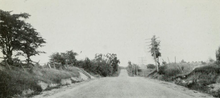
It exits the town travelling southeast as a rural two-lane highway running roughly parallel and south of the Maitland River, passing through farmland outside of the many small communities it serves.
East of Stratford, the highway narrows back to two lanes and travels north of and parallel to the CN railway Guelph Subdivision.
After passing through the village of Shakespeare, the route enters the Regional Municipality of Waterloo as it widens to four lanes and curves onto the New Hamburg Bypass.
It crosses over the Grand River at its midpoint, followed by a partial interchange with King Street East that provides access to Highway 401 westbound to London.
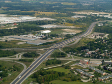
It bypasses the communities of Sheffield and Rockton before eventually reaching Peters Corners, where it meets the western terminus of Highway 5 at a multilane roundabout.
[12][16] When settlers began arriving in the Niagara Peninsula following the American Revolution and the signing of the Treaty of Paris in 1783, natives were non-existent in the area, the local tribe having been ravaged over a century earlier.
The Iroquois Trail was utilised by famous historical figures, including John Graves Simcoe in 1793 on his voyage to Detroit, as well as during the War of 1812.
[18] Between approximately 1800 and 1820, large numbers of German and Dutch settlers from Pennsylvania travelled west across the Niagara Peninsula and onward to the Waterloo area.
[24] In order to implement the grand settlement plan, a trail was surveyed by Mahlon Burwell and William Dunlop from Guelph to Lake Huron at the mouth of the Maitland River beginning in 1827.
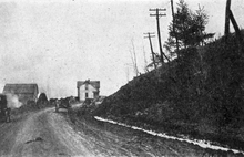
[10] After company commissioner Thomas Mercer Jones rode the muddy trail from Guelph to Goderich in June 1829, he recommended that it be widened to four rods (20 metres (66 ft)),[25] which was done by the end of that year by Colonel Anthony Van Egmond.
The Department of Public Works and Highways paid up to 60% of the construction and maintenance costs for these roads, while the counties were responsible for the remaining 40%.
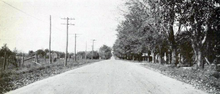
During the initial few years of the existence of the highway network, which were spent rebuilding culverts, bridges, and ditches, paving took a low priority.
[51] Smith proposed a complete reorganisation of the downtown area, including converting Main Street – which Highway 8 followed through the city[52] – to an eastbound one-way.
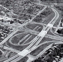
[53][54][55] Although the concept of a ring road around Kitchener and Waterloo originated from the Kitchener-Waterloo and Suburban Planning Board in 1948,[56][57] actual consideration was not given to it until it was recommended by a 1961 traffic study.
[56] The provincial government reached a funding arrangement with Kitchener and Waterloo to cover 75% of the expected C$22 million cost, and officially announced the Kitchener–Waterloo Expressway on May 21, 1964.
[65] Construction began several months later in October on a C$3.6 million contract to build a 2.9-kilometre (1.8 mi) segment of the parkway from King Street to west of Homer Watson Boulevard.
Having largely been supplanted by the Queen Elizabeth Way, opened in the 1940s, the winding route of Highway 8 east of Winona was transferred to the new Regional Municipality of Niagara on September 1, 1970.
[67][73] Around this time, construction was underway on a new two lane alignment of Highway 7/8, first announced in 1963, to connect the New Hamburg Diversion with the Conestoga Parkway.
[76] Although the proposal was shelved in 1988,[77] the bypass idea was briefly revived as a result of recommendations in the Cambridge Area Transportation Study, released in June 1992.
[84][85][86] Construction began to widen the route as far west as Waterloo Regional Road 12 (Queen Street), south of Petersburg, on July 6, 1992, with a planned completion by August 1993.
committee to determine cost-cutting measures in order to balance the budget after a deficit incurred by former premier Bob Rae.
[88] It was determined that many Ontario highways no longer served long-distance traffic movement and should therefore be maintained by local or regional levels of government.
A 2.3-kilometre (1.4 mi) section of King Street in Kitchener, from north of the Highway 401 interchange to the Freeport Diversion, was also transferred on that day to the Regional Municipality of Waterloo.
[97] Construction instead began in April 2002, which involved shifting one of the retaining walls further north and a new Franklin Street bridge to accommodate the eight lane cross-section freeway.
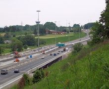
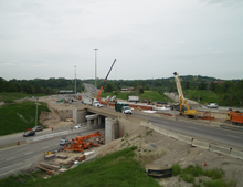
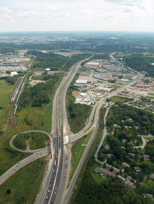
[99] Work began on the next phase, widening Highway 8 from four to eight lanes from Fergus Avenue to northwest of the Grand River, in April 2006.
[100] Construction to twin Highway 8 over the Grand River and widen it northwest of the Sportsworld Drive interchange began in the summer of 2009, following the relocation of approximately 50 Wavy-rayed lampmussel, considered a species at risk in Canada.
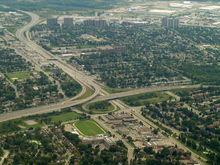
Studies, including an environmental assessment were conducted between 2004 and 2009, and settled upon a roundabout as the ideal replacement, with traffic signals at the two intersections with Westover Road.
[106] Although a detailed design for two additional ramps to provide access to and from the west to Highway 8 was prepared in 2010, there is no schedule or funding as of 2021 for this work.