History of Albany, New York
The area was originally inhabited by an Algonquian Indian tribe, the Mohicans, as well as the Iroquois, five nations of whom the easternmost, the Mohawk, had the closest relations with traders and settlers in Albany.
It is one of the oldest surviving settlements from the original Thirteen Colonies, and the longest continuously chartered city in the United States.
It is located on the north end of the navigable Hudson River, was the original eastern terminus of the Erie Canal, and was home to some of the earliest railroad systems in the world.
The city's skyline changed in the 1960s with the construction of the Empire State Plaza and the uptown campus of SUNY Albany,[Note 1] mainly under the direction of Governor Nelson Rockefeller.
Albany has been a center of higher education for over a century, with much of the remainder of its economy dependent on state government and health care services.
[2] Albany is one of the oldest surviving European settlements from the original Thirteen Colonies[3] and the longest continuously chartered city in the United States.
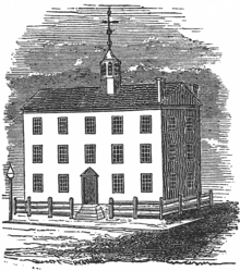
[7][Note 3] Albany's first European structure may have been a primitive fort on Castle Island built by French traders ca.
[14][15] Over the next several decades, the Mohawk, Mohican and Dutch formed a different relationship "based on a sense of mutual opportunity, of seeing more advantage in cooperation than in conflict.
Like French traders before them, the Dutch often married or had unions with Mohawk and Mahican women; their descendants later intermarried with English settlers as well, leading to the area's cultural history being expressed in complex bloodlines.
[19] The Dutch briefly regained Albany in August 1673 and renamed the city Willemstadt; the English took permanent possession with the Treaty of Westminster (1674).
It ended in 1763 with French defeat by the British, resolving a situation that had been a constant threat to Albany and held back its growth.
After Horatio Gates' win over John Burgoyne at Saratoga in 1777, the upper Hudson Valley was generally at peace as the war raged on elsewhere.
From statehood to this date, the Legislature had frequently moved the state capital between the city of New York, Kingston, Hurley, Poughkeepsie and Albany.
[41][42] The advent of the turnpike, in conjunction with canal and railroad systems, made Albany the hub of transportation for pioneers going to Buffalo and the Michigan Territory in the early and mid-19th century.
[49][50] In 1829, while working as a professor at the Albany Academy, Joseph Henry, widely regarded as "the foremost American scientist of the 19th century",[51] built the first electric motor.
He was appointed as the first Secretary of the Smithsonian Institution in Washington, DC, which supported a variety of scientific, ethnographic and historic research.
The city's location at the east end of the Erie Canal gave it unparalleled access to both raw products and a captive customer base in the west.
The iron industry waned by the 1890s, falling victim to the costs associated with a newly unionized workforce and competition from the opening of mines in the Mesabi Range in Minnesota.
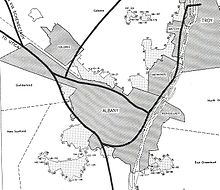
[78] By 1916 Albany's northern and southern borders reached their modern courses;[77] Westerlo Island, to the south, became the second-to-last annexation, which occurred in 1926.
They found crowded living conditions and limited employment opportunities, but also higher wages and better schools and social services.
Local organizations such as the Albany Inter-Racial Council and churches, helped them, but de facto segregation and discrimination remained well into the late 20th century.
[82] Although he was the longest-serving mayor of any city in United States history (1942 until his death in 1983), one historian describes Corning's tenure as "long on years, short on accomplishments.
[Note 8] During the 1950s and 1960s, a time when federal aid for urban renewal was plentiful,[84] Albany did not see much progress in either commerce or infrastructure.
It lost more than 20 percent of its population during the Corning years, and most of the downtown businesses moved to the suburbs, following residents who had gone to newer housing.
[86] While many cities across the country struggled with similar issues, the problems were magnified in Albany: interference from the Democratic political machine hindered progress considerably.
Rockefeller did not want to be limited by the Legislature's power of the purse, so Corning devised a plan to have the county pay for the construction and have the state sign a lease-ownership agreement.
[89] Another major project of the 1960s and 1970s was Interstate 787 and the South Mall Arterial, part of massive highway building across the country in this period.
As happened in other places, the highway project had the adverse effect of cutting off the city from the Hudson River, which was the basis of its settlement.
[90] Much of the original highway plan was never constructed, however: Rockefeller had wanted the South Mall Arterial to pass through the Empire State Plaza.
The project would have required an underground trumpet interchange below Washington Park, connecting to the (eventually cancelled) Mid-Crosstown Arterial.