History of Yukon
The history of the Yukon covers the period from the arrival of Paleo-Indians through the Beringia land bridge approximately 20,000 years ago.
At about AD 800, a large volcanic eruption in Mount Churchill near the Alaska border blanketed the southern Yukon with ash.
Similar stories are told among the Athabaskan-speaking Navajo and Apache, leading to the conclusion by some anthropologists that the migration of Athabaskan peoples into what is now the southwestern United States could have been due to the eruption.
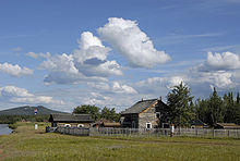
[7] Besides Athabaskan, on the Arctic coast of modern Yukon, including Herschel Island, there lived the Inuit (Eskimo).
A new trading post, Rampart House was established upstream along the Porcupine, but it also proved to be just inside Alaska's boundary.
Kenicott became popular with Hudson's Bay Company fur traders in the area and encouraged them to collect and send natural history specimens and First Nations artifacts to the Smithsonian.
Three miners — Alfred Mayo, Jack McQuesten, and Arthur Harper — having heard of these rumours, went to work for the Alaska Commercial Company as traders, although their main interest was in the gold prospects.
In 1885, a paying amount of gold was found on the Stewart River, and McQuesten convinced the Alaska Commercial Company to start catering to miners rather than focusing only on the fur trade.
At the same time as the initial gold discoveries were being made, the US Army sent lieutenant Frederick Schwatka to reconnoiter the Yukon River.
Going over the Chilkoot Pass, his party built rafts and floated down the Yukon River to its mouth in the Bering Sea, naming many geographic features along the way.
William Ogilvie, a surveyor who was later to become famous during the Klondike gold Rush and was part of Dawson's expedition, surveyed the boundary with Alaska.
In 1894, concerned about the influx of American miners and the liquor trade, the Canadian government sent inspector Charles Constantine of the North-West Mounted Police to examine conditions in the Yukon district.
A party led by Skookum Jim Mason discovered gold in Bonanza Creek, a tributary of the Klondike River, in August 1896.
An estimated 30,000 to 40,000 people braved numerous hardships to reach the Klondike gold fields in the winter and spring of 1897-1898 after the discovery became known in 1897.
With the influx of American stampeders, the Canadian government decided to create a separate territory to better control the situation.
The influx of people greatly stimulated mineral exploration in other parts of the Yukon and led to two subsidiary gold rushes in Atlin, British Columbia and Nome, Alaska as well as a number of mini-rushes.
The line continued northward, past the village of Ketchumstuck, and the forked, one branch going west to Fairbanks and the other to the military post at Eagle.
In 1912 the Protestant Episcopal Church purchased the telegraph installation at Tanana Crossing and established St. Timothy's mission.
In the Klondike, individual miners' claims were bought out and consolidated with the help of the government by a small number of companies, including the Guggenheim's Yukon Gold Corporation who used large floating dredges.
The next important event in Yukon's history was the construction of the Alaska Highway during the Second World War, which, after its badly needed reconstruction by the Canadian Government in the late 1940s, opened up the territory to road traffic.
However, the influx of southern highway construction crews had a devastating effect on some First Nations, who suffered from a large number of deaths from diseases to which they had no immunity.
On another front, First Nations started lobbying and entered in land claims negotiations in the 1970s which culminated in the signing of an "Umbrella Final Agreement" in 1992.
Today, the Canadian government is investing in clean energy research and environmental protection in the territory, with one of the goals being the increased involvement of the First Nations, Inuit and Métis peoples in the northern economy.