History of geodesy
Early arguments for a spherical Earth pointed to various more subtle empirical observations, including how lunar eclipses were seen as circular shadows, as well as the fact that Polaris is seen lower in the sky as one travels southward.
The historian Dmitri Panchenko hypothesizes that it was the Phoenician circumnavigation of Africa that inspired the theory of a spherical Earth, the earliest mention of which was made by the philosopher Parmenides in the 5th century BC.
The method was based on several surveying trips conducted by professional bematists, whose job was to precisely measure the extent of the territory of Egypt for agricultural and taxation-related purposes.
Geographia indicated the countries of "Serica" and "Sinae" (China) at the extreme right, beyond the island of "Taprobane" (Sri Lanka, oversized) and the "Aurea Chersonesus" (Southeast Asian peninsula).
Calcidius's fourth-century Latin commentary on and translation of Plato's Timaeus, which was one of the few examples of Greek scientific thought that was known in the Early Middle Ages in Western Europe, discussed Hipparchus's use of the geometrical circumstances of eclipses in On Sizes and Distances to compute the relative diameters of the Sun, Earth, and Moon.
[43][44] Theological doubt informed by the flat Earth model implied in the Hebrew Bible inspired some early Christian scholars such as Lactantius, John Chrysostom and Athanasius of Alexandria, but this remained an eccentric current.
[45] Such widely read encyclopedists as Macrobius and Martianus Capella (both 5th century AD) discussed the circumference of the sphere of the Earth, its central position in the universe, the difference of the seasons in northern and southern hemispheres, and many other geographical details.
The cosmographic theories[clarification needed] and assumptions in ancient India likely developed independently and in parallel, but these were influenced by some unknown quantitative Greek astronomy text in the medieval era.
[34] The Islamic theoretical framework largely relied on the fundamental contributions of Aristotle (De caelo) and Ptolemy (Almagest), both of whom worked from the premise that Earth was spherical and at the centre of the universe (geocentric model).
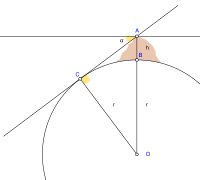
[63] Abu Rayhan Biruni (973–1048), in contrast to his predecessors, who measured Earth's circumference by sighting the Sun simultaneously from two different locations, developed a new method of using trigonometric calculations based on the angle between a plain and mountain top.
[64][65][66] Biruni's method was intended to avoid "walking across hot, dusty deserts", and the idea came to him when he was on top of a tall mountain in India (present day Pind Dadan Khan, Pakistan).
[78] A list of more than a hundred Latin and vernacular writers from Late Antiquity and the Middle Ages who were aware that Earth was spherical has been compiled by Reinhard Krüger, professor for Romance literature at the University of Stuttgart.
"[86] The 7th-century Armenian scholar Anania Shirakatsi described the world as "being like an egg with a spherical yolk (the globe) surrounded by a layer of white (the atmosphere) and covered with a hard shell (the sky)".
[87] During the High Middle Ages, the astronomical knowledge in Christian Europe was extended beyond what was transmitted directly from ancient authors by transmission of learning from Medieval Islamic astronomy.
Thus we know that the celestial bodies are spherical.However, Shen's ideas did not gain widespread acceptance or consideration, as the shape of Earth was not important to Confucian officials who were more concerned with human relations.
[94]Although mainstream Chinese science until the 17th century held the view that Earth was flat, square, and enveloped by the celestial sphere, this idea was criticized by the Jin-dynasty scholar Yu Xi (fl.
[108][109][110][111] The French Academy of Sciences had commissioned an expedition led by Jean Baptiste Joseph Delambre and Pierre Méchain, lasting from 1792 to 1799, which attempted to accurately measure the distance between a belfry in Dunkerque and Montjuïc castle in Barcelona at the longitude of Paris Panthéon.
[116][117] In South America Bouguer noticed, as did George Everest in the 19th century Great Trigonometric Survey of India, that the astronomical vertical tended to be pulled in the direction of large mountain ranges, due to the gravitational attraction of these huge piles of rock.
In 1860 Friedrich Georg Wilhelm Struve published his Arc du méridien de 25° 20′ entre le Danube et la Mer Glaciale mesuré depuis 1816 jusqu’en 1855.
[116] In the early 19th century, the Paris meridian's arc was recalculated with greater precision between Shetland and the Balearic Islands by the French astronomers François Arago and Jean-Baptiste Biot.
This new survey of the Paris meridian arc, named West Europe-Africa Meridian-arc by Alexander Ross Clarke, was undertaken in France and in Algeria under the direction of François Perrier from 1870 to his death in 1888.
The British Government invited those of France, Belgium, Prussia, Russia, India, Australia, Austria, Spain, United States and Cape of Good Hope to send their standards to the Ordnance Survey office in Southampton.
Following the example set by this country and under the patronage of the International Geodetic Association, Austria, Bavaria, Prussia, Russia and Saxony undertook gravity determinations on their respective territories.
These movements were particularly important with the device designed by the Repsold brothers on Bessel's indications, because the pendulum had a large mass in order to counteract the effect of the viscosity of the air.
While Emile Plantamour was carrying out a series of experiments with this device, Adolphe Hirsch found a way to highlight the movements of the pendulum suspension plane by an ingenious optical amplification process.
Isaac-Charles Élisée Cellérier, a Genevan mathematician and Charles Sanders Peirce would independently develop a correction formula which would make it possible to use the observations made using this type of gravimeter.
Only when this series of metrological comparisons would be finished with a probable error of a thousandth of a millimeter would geodesy be able to link the works of the different nations one with another, and then proclaim the result of the measurement of the Globe.
After an in-depth discussion in which Charles Sanders Peirce took part, the association decided in favor of the reversion pendulum, which was used in Switzerland, and it was resolved to redo in Berlin, in the station where Bessel made his famous measurements, the determination of gravity by means of apparatus of various kinds employed in different countries, in order to compare them and thus to have the equation of their scales.
In 1810, after reading Gauss's work, Pierre-Simon Laplace, after proving the central limit theorem, used it to give a large sample justification for the method of least squares and the normal distribution.
[116] Most of the relevant theories were then derived by the German geodesist Friedrich Robert Helmert in his famous books Die mathematischen und physikalischen Theorien der höheren Geodäsie, Volumes 1 & 2 (1880 & 1884, resp.).


(1482, by Nicolaus Germanus )