Honey War
The dispute over a 9.5-mile-wide (15.3 km) strip running the entire length of the border, caused by unclear wording in the Missouri Constitution on boundaries, misunderstandings over the survey of the Louisiana Purchase, and a misreading of Native American treaties, was ultimately decided by the United States Supreme Court in Iowa's favor.
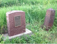
Before the issue was settled, militias from both sides faced each other at the border, a Missouri sheriff collecting taxes in Iowa was incarcerated, and three trees containing beehives were cut down.
Various tribes met with United States representatives at Portage Des Sioux, Missouri, in 1815 to formally end the war.
The treaty permitted the United States to survey the new land and they were to "adjust" the boundaries for a starting point 23 miles (37 km) west to the mouth of the Kansas River with the Missouri River in Kansas City, Missouri on the far bank opposite Kaw Point.
In 1816 United States surveyor John C. Sullivan was instructed to survey a line north from the mouth for 100 miles (160 km) and then proceed east to the Des Moines River.
When Missouri applied for statehood first in 1818 various proposals for boundaries were put forth including a western boundary at the mouth of the Nodaway River about 30 miles (48 km) west and the mouth of the Rock River (Illinois) opposite Rock Island, Illinois.
In the Indian Removal Act of 1830, all tribes were moved west and south of the line, Sullivan had drawn.
Meanwhile, Iowa was to maintain its ownership extended to a line about 15 miles (24 km) into modern Missouri at the mouth of the Des Moines.