Illawarra escarpment
The range encloses the Illawarra region which stretches from Stanwell Park in the north to Kiama, Gerringong and the Shoalhaven River in the south.
This forms the eastern edge of the Southern Highlands plateau, uplifted along with the Blue Mountains around 70 million years ago.
The southern typical bush meets the northern at Mount Kembla, creating a unique effect.
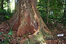
Many native species thrive here such as wallabies, brushtail possums and gliding possums, frogs, goannas, brush turkeys, flying foxes, snakes, bower birds, glossy black cockatoos and other colourful parrots, owls and native birds of prey.
Geographically it stretches from the white cliffs of the Royal National Park and its northern hilly ridge formations like Bulgo and Otford Hills and Stony Batter, Undola Ridge and Bald Hill, south past the Otford Valley to the west and around an eroded valley containing Stanwell Park, then it goes south, featuring cliffs and running close to the coastal headlands, approximately 300 metres (1,000 ft) above sea level at Scarborough to the turn at Sublime Point at 415 metres (1,362 ft) near Thirroul, south to Brokers Nose at 440 metres (1,440 ft) promontory, south to Mount Keira, which juts out from the main cliffs, south to a similar eroded sandstone outcrop, Mount Kembla at 534 metres (1,752 ft), then southwest along the Dapto scarp cliffs including Mount Bong Bong to the turn inland at Macquarie Pass, then back east to the promontory at Knights Hill at 709 metres (2,326 ft), south including Jamberoo Mountain and east to Noorinan Mountain promontory at Barren Grounds Plateau, then along a ridge to its southern tip, Saddleback Mountain.
The flora ranges from northern and southern eucalypts and at Mount Kembla fuses, providing an interesting phenomena.
To the north the range is mostly a coastal ridge east of Otford, becoming a cliff at Mount Mitchell, and continuing to include an eroded cliff at its top until Bulli Pass where it becomes rounded, forming Woonona Mountain, until Brokers Nose where the cliff reappears, before appearing again on the edge of Mount Keira and Warra, disappearing until west of Dapto where it forms the famous southern escarpment and curves in for Macquarie Pass National Park and Mount Murray at 768 metres (2,520 ft) before turning into Knights Hill at 709 metres (2,326 ft) and then forming Noorinan promontory, its summit at 663 metres (2,175 ft), and Saddleback Mountains.
There are several passes over the escarpment: Saddleback Mountain Road only reaches the summit after a short, steep, turnoff, but was once part of Hoddles Track, which is now only in existence in a small ridge track from the summit but used to extend west to the Southern Highlands.