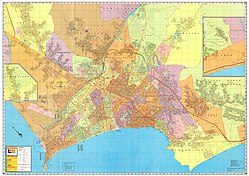
Independencia District, Lima
On the morning of November 17, 1960, some families, entered the deserts along kilometers 5 and 6 of Túpac Amaru Avenue, the old road to Canta, in a very organized manner.
In the following years, the area of Pampa de Repartición located at kilometer six and a half, in the district of Comas, was urbanized, establishing the Tahuantinsuyo Urbanization; then the land of Pampa El Ermitaño in Rímac District was occupied, located at kilometer four, other extensions of land would later be populated, integrating the human settlements of the peripheries.
On the other hand, San Martin de Porres argues that the law creating Los Olivos does not detail the cession of territory to other districts not involved in addition to not having been an express request of the residents.
In 1998, residents of the Naranjal urbanization identified with San Martín de Porres confronted the Mayor of Independencia, Guillermo Chacaltana, and his aldermen in a brawl on Los Alisos avenue.
In 2015, residents of San Martín de Porres blocked the Panamericana Norte highway for about 45 minutes to demand that their area not be assigned to the district of Independencia through a bill.
In December of the same year, a confrontation between neighbors and serenading of both municipalities in the Mercado Naranjal, with the intervention of the police and the prosecutor's office.
[4] The district of Independencia is generally enabled by popular families of medium, medium-low and low socioeconomic status.