Indian Himalayan Region
The Indian Himalayan Region (abbreviated to IHR) is the section of the Himalayas within the Republic of India, spanning thirteen Indian states and union territories, namely Ladakh,[1] Jammu and Kashmir,[2][3][4] Himachal Pradesh, Uttarakhand, Sikkim, West Bengal, Manipur, Meghalaya, Mizoram, Nagaland, Tripura, Assam, and Arunachal Pradesh.
[5][6][7][8] The region is responsible for providing water to a large part of the Indian subcontinent and contains various flora and fauna.
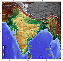
[9] Physiographically, the Himalayas start from the foothills of south (Sivaliks) and extend up to the Tibetan plateau of the north (Trans-Himalaya).
Huge but older waterways like the Indus, Sutlej, Kali, Kosi and Brahmaputra cut steep gorges through the main Himalayan range to escape into the Great Plains, establishing their antecedence.
At the eastern end, some portion of the Kangri Karpo (a trans-Himalayan range) forms part of the northern boundary of Arunachal Pradesh with Tibet.
To the south of the main Himalayas lies the lesser Himalayan Pir Panjal Range, with an average height of 5,000 metres (16,000 ft), in Jammu and Kashmir and Himachal Pradesh.
Sivaliks extend over a width of 10–50 km, and have an altitude varying between 900 m and 1100 m. These ranges are called by different names in different regions: These parts consist of thick gravel and alluvium.