Indian Standard Time
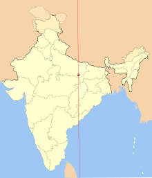
[5] Indian Standard Time is calculated from the reference longitude of IST at 82°30'E passing near Mirzapur Clock Tower.
Currently, the National Physical Laboratory of India maintains the Indian Standard Time with the help of the Allahabad Observatory.
[9] The country's east–west distance of more than 2,933 kilometres (1,822 mi) covers over 29° of longitude, resulting in the sun rising and setting almost two hours earlier on India's eastern border than in the Rann of Kutch in the far west.
Inhabitants of the northeastern states have to advance their clocks with the early sunrise to avoid the extra consumption of energy after daylight hours.
[6][10] In 2001, the government established a four-member committee under the Ministry of Science and Technology to examine the need for multiple time zones and daylight saving.
In June 2017, the Department of Science and Technology (DST) indicated that it is once again studying the feasibility of two time zones for India.
With an atomic clock in each of the four other centers—Ahmedabad, Bengaluru, Bhubaneswar, and Guwahati—the reference time from NavIC will be transmitted via an optical fiber link from the Faridabad center.