Interstate 694
I-694 begins on the counterclockwise end at the junction of I-94, I-494, US 52, and I-694 in the city of Maple Grove, often referred to as the Fish Lake Interchange.
In Brooklyn Center, I-94/US 52 splits from I-694 and then I-94/US 52 travels south toward downtown Minneapolis, while I-694 continues its beltway function, crossing the Mississippi River on the I-694 Bridge.
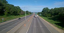
I-694 turns slightly to the southeast as it passes through the communities of Arden Hills, Shoreview, and Little Canada.
It continues east through the communities of Vadnais Heights, White Bear Lake, and Maplewood.
That bridge was constructed as part of a defense initiative authorized in 1942 at the beginning of US involvement World War II.
These include the cities of Maple Grove, Brooklyn Park, Brooklyn Center, Fridley, New Brighton, Arden Hills, Shoreview, Little Canada, Vadnais Heights, White Bear Lake, Maplewood, Pine Springs, and Oakdale.
The project was designed around several factors, a few of which included increasing freeway traffic capacity, increasing driver safety, and eliminating weaving and lane changes (eliminating "geometric deficiencies"), hence the name of the project, "Unweave the Weave".
As a result of lane changing and constant congestion, many accidents occurred on the interchange after its completion in the early 1970s.
[7] The current layout of the two Interstates now provides for safer exits and entrances, minimal congestion, and better road surface durability.
This interchange often created one of the worst bottlenecks in the Twin Cities because drivers need to change at least one lane to continue either direction on I-694 between MN 51 (Snelling Avenue) and US 10.