Interstate 80 in Illinois
I-80 extends from west to east across the northern portion of the state through the population centers of the Quad Cities and south Chicago suburbs.
[4] I-80 enters Illinois on the Fred Schwengel Memorial Bridge over the Mississippi River, southwest of Rapids City.
The highway heads south, as a four-lane Interstate, passing along the east side of the Quad Cities.
The Interstate continues toward the east having a folded diamond interchange with IL 40, before having rest areas on both sides of the roadway.
The highway passes on the north side of Princeton, having an interchange with IL 26, near a commercial part of the city.
In LaSalle, the highway has a diamond interchange with 103 Road, just north of the Illinois Valley Regional Airport.
The highway leaves Morris, passing through farmland and having a rural interchange with a county road.
In Minooka, the Interstate curves the east, before turning back toward the northeast and leaving the village.
The road has a folded diamond interchange with US 30, before passing southeast of Potawatomi Woods County Forest Preserve.
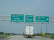
The Interstate has a single-point urban interchange (SPUI) with IL 83 and the western end of the US 6 concurrency.
Common among most of the rest stops are restrooms, payphones with TDD capabilities, weather information, picnic areas, and vending machines.
The eastbound rest area near Rapid City does not allow large trucks and does not have vending machines or TDD capabilities.
Like most of the other Oasises, this location has several fast-food restaurants, gas stations, convenience stores, visitor centers, and free wireless internet.
The second section was named Sunset Trail, and it traveled between Princeton and Ottawa, passing through LaSalle.
[11][12] The US Numbered Highway System was approved on November 11, 1926,[13] and US 32 was routed between Rock Island and Princeton.
[15][16] Construction of a test track for the Interstate Highway System between Utica and Ottawa began in 1952.
[21][22] In 1962, the highway was extended west to IL 89, near LaSalle, replacing and paralleling the test track most of the way to Utica.
[35][36] In 2020, the Illinois Department of Transportation began a study, which is expected to cost $20,000, to replace the bridge.
By 2025, Illinois is expected to spend $23 billion on concrete, as well as fixing and expanding 4,200 miles (6,800 km) of roadways and 9 million square feet (836,000 m²) of bridge decks.
The Illinois department will be the lead agency on the project with the state of Iowa sharing in the costs.
[38] A separate multi-use pathway for bicyclists and pedestrians will be included as well as upgrades to the interchanges at both ends of the bridge.
On March 18, 2021, a plan was announced by Chad Pregracke to repurpose the Fred Schwengel Memorial Bridge into a national park.
The proposal gives an estimate that taxpayers would save 30 to 40 million dollars by foregoing the demolition of the bridge.
The project would allow both bison and pedestrians to roam freely between Iowa and Illinois and also place a visitor center directly on the bridge.