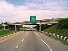
Interstate 96
Though maps still refer to the freeway as the Jeffries, the portion within the city of Detroit was renamed by the state legislature as the Rosa Parks Memorial Highway in December 2005 in honor of the late civil rights pioneer.
I-96 is maintained by the Michigan Department of Transportation (MDOT) as a segment of the larger State Trunkline Highway System.
In 2011, the department's traffic surveys showed that on average, 201,200 vehicles used the highway daily between 6 and 7 Mile roads in Livonia.
At the starting terminus, the highway has a grassy median and two lanes in each direction as it travels southeasterly through rural Muskegon County.
[9][10] Beyond Marne, I-96 passes the western end of M-11 and crosses into Kent County, curving around a rest area for the eastbound lanes.
At the interchange with Alpine Avenue, M-37 merges onto the freeway and the two run concurrently past the studios for WZZM-TV[9][10] with its iconic weatherball, a 16-foot-wide (4.9 m) sphere 100 feet (30 m) above the ground that uses colored lights to display a weather forecast.
[9][10] These ramps mark the northern end of I-296, an unsigned auxiliary Interstate Highway designation applied to them and the US 131 freeway south to downtown Grand Rapids.
[3] I-96 turns northeasterly past a commercial area to a three-quarter cloverleaf interchange that provides all of the other connections with US 131 next to a crossing of the Grand River.
[9][10] East of the river, I-96 and M-37 pass through the northern suburb of Comstock Park, intersecting Connector M-44 (Conn. M-44, Plainfield Avenue) near Lamberton Lake.
[9][10] These two Interstates run southward together for about 6.5 miles (10.5 km) on the west side of the metropolitan area, picking up a third lane in each direction.
The trunkline passes near residential subdivisions, and next to the interchange for BL I-69/M-43 (Saginaw Highway), there is a large retail development.
It passes through areas with residential subdivisions and commercial developments, coming to a pair of interchanges including one for the eastern end of BL I-96 (Cedar Street).
East of that interchange, the freeway begins to exit the metro area as the landscape transitions back to farm fields.
From this point, the freeway expands to six lanes and runs parallel to Grand River Avenue on the southern side of town.
On the northeast side of Brighton, I-96 crosses over Grand River Avenue and the landscape transitions to include residential subdivisions.
Southeast of the mall, I-96 enters a complex interchange on the border between Novi and Farmington Hills that connects it to M-5 (Haggerty Connector), I-275 and I-696 (Reuther Freeway).
[10][12] According to the Federal Highway Administration, I-275 ends at the junction with I-96 and M-14 along the boundary between Livonia and Plymouth Township and not at the interchange in Novi and Farmington Hills.
Even before the National Interstate and Defense Highways Act was signed in 1956, the route was being planned as a replacement of the old US 16, which was decommissioned in the state in 1962.
[26] Michigan, believing that this would "cause considerable confusion to the public", requested a change in April 1958, which would move I-94 to the shorter Kalamazoo route (which was planned as I-92), make the Muskegon–Detroit route I-96, and assign I-67 to the connection from I-94 to I-96 at Grand Rapids,[27] but this was initially rejected by the American Association of State Highway Officials (AASHO).
[35] In 1963, the Michigan State Highway Department petitioned AASHO to again make the change it had requested back in 1958, moving I-96 over I-196 to end at Muskegon and renumbering I-96 west of Grand Rapids to I-67.
The state cited problems with destination signing and numerous complaints from the public about confusion caused by the numbering.
[36] At their October 21, 1963, meeting, AASHO approved the relocation of I-96, but rejected I-67, stating that the number should be kept for a more major route in case the system is expanded, and instead assigned I-196 to the not-yet-complete Benton Harbor–Grand Rapids highway.
To minimize the impact to existing communities and businesses, it was decided that the Jeffries Freeway would no longer utilize the Grand River Avenue corridor.
The project aimed to improve access to the Gerald R. Ford International Airport southeast of Grand Rapids.
[68] MDOT started work to add a flex route on I-96 between Kent Lake Road and the I-275/I-696/M-5 interchange in Novi on March 21, 2022.
Under this plan, the shoulders of the highway will be available as extra lanes during peak traffic periods, and indicated with overhead light systems.
[70] Beginning on February 25, 2008, MDOT and the Detroit International Bridge Company initiated the Ambassador Gateway Project at the eastern end of I-96.
[76] On January 12, 2005, a large multiple-vehicle collision consisting of over 200 motor vehicles occurred on both directions of I-96 near Williamston in Ingham County.
[77] In October 2012, reports of a sniper shooting cars along I-96 in four counties led to a federal investigation and a multi-jurisdictional task force of 100 law enforcement officials.
The trial for the Livingston County case began on January 14, 2014,[84] and after being convicted on the terrorism charge, Casteel was sentenced to 16 to 40 years in state prison.