Italian Benghazi
Indeed, the Italians conquered from the Ottomans in 1911 a region in coastal Cyrenaica that was very poor and underdeveloped: it had no asphalted road, no telegraph services, no sewages system and no hospitals (in 1874 Benghazi had been depopulated by the bubonic plague).
Inside the greater Port in the 1930s was created a modern "Idroscalo" (seaplane station) for the flights between "Bengasi italiana" and Italy.
The route was enlarged to 6,379 km and initially joined Rome with Addis Ababa via Syracuse, Benghazi, Cairo, Wadi Halfa, Khartoum, Kassala, Asmara, Dire Dawa.
In the coast of the province was built in 1937-1938 a section of the Via Balbia, a road that went from Italian Tripoli and Tunisia's frontier to the border of Egypt.
The first Italian infrastructures in Benghazi dated at the time of the conquest, in late 1911, when was done the enlargement of the small Ottoman port that was greatly improved and when was created the communication network with the interior through the construction of two railway lines.
While the facades were designed by the architect Ivo Lebboroni, the interior frescoes are the work of Guido Cadorin, and the chandeliers are by Umberto Bellotto.
[20] The portico of the facade and the interiors were designed by Roman architect Marcello Piacentini: the style of his buildings is characteristic of the Neo-Moorish period of Italian colonial architecture in Libya in the 1920s.
[21] In 1928 the Milan Studio of architecture owned by Alpago Novello, Cabiati and Ferrazza, got the task of studying a "Plan of Benghazi", where they had already designed the Cathedral (built in 1928–34), located in the Square "Martiri Fascisti" (Fascist Martyrs).
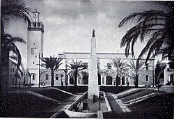
Furthermore, in the 1930s many architects came from Italy to work and create the new "Bengasi italiana": Limongelli, Alpago Novello, Cabiati, Ferrazza, Di Fausto, Rava, Piccinato, Pellegrini, Gennari and Di Segni were the most famous[22] The new Benghazi therefore was developed between the old city and the suburb of Berca through the isthmus situated between the "Punta Saline" in the West, where arose the "Industrial basin and Docking area", and the saline Ain es-Selmani eastward.
The goal was to merge in an organic unity the distinct areas of the city incorporating the existing structures: although the trend, at least for the old section, was always that of separation from the Italian-populated city, as demonstrated with the enlargement of Aghib street and the expansion planned for the axis of Via Roma and Via Generale Briccola, where in some buildings were built huge arcades (as in northern Italy).
[23] The Cathedral -an example of neo-classical architecture- was designed with an entrance that has a portico with six Doric columns, by the Italian famous architects Guido Ottavo and Ottavio Cabiati.
Cabiati also created the "Palazzo del Governatore" (later called "Al Manar Palace" and campus site of the University of Libya) and the large "Lungomare" (promenade).