James City County, Virginia
The College of William and Mary is nearby, as well as NASA, Jefferson Laboratory, and numerous defense contractors, giving the region the highest concentration of scientists and engineers per capita in the nation.
Upon reaching the New World at Cape Henry, they selected a site to settle about 40 miles (64 km) inland from the coast along a river to be better protected from attacks by sea from other Europeans.
Soon after the establishment of Jamestown in 1607 in the new Colony of Virginia, English settlers first explored and then began settling more of the areas adjacent to Hampton Roads and along the James River.
In 1619, the Virginia Company of London under a new leader, Sir Edwin Sandys, instituted a number of changes, to help stimulate more investment and attract settlers from England.
In the long view, foremost among these was the establishment of what became the House of Burgesses, the first representative legislative body in the European settlement of North America, predecessor of today's Virginia General Assembly, first convened by a Royal Governor, Sir George Yeardley, of Flowerdew Hundred Plantation.
The Virginia Company's "James Cittie" stretched across the Peninsula to the York River, and included the seat of government for the entire colony at Jamestown Island.
However, the population of the town, named for Sir John Wolstenholme, a principal of the Martin's Hundred Society investors back in England, was severely decimated during the Indian massacre of 1622, and many men, women and children were killed or abducted.
Another 200 years later, the long-lost site of Wolstenholme Towne was rediscovered in 1976 during an archaeological dig overseen by Ivor Noel Hume after the Carter's Grove Plantation property came under the ownership of Colonial Williamsburg Foundation.
Middle Plantation and James City County were selected for the site of the College of William and Mary in 1693 and became the location of the capital in 1699 after Jamestown was burned (again) in 1698.
After the War, Collis P. Huntington extended the new Chesapeake and Ohio Railway through the county to reach new coal piers he had built at Newport News on Hampton Roads.
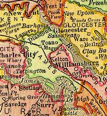
Railroad stations were established (listed west to east) at Diascund, Toano, Vaiden's Crossing, Kelton, Ewell, Williamsburg, and Grove.
Beginning in the early 20th century, preservation and restoration efforts resulted in a major increase in tourism to the county and surrounding area.
Perhaps the best-known of the 20th century changes of a local nature which affected James City County was the Restoration and development of Colonial Williamsburg.
Even in modern times, pathways from the Colonial Parkway and from the relocated U.S. Route 60 at Bypass Road and North Henry Street are without commercial development.
When Interstate 64 was planned and built in the 1960s and early 1970s, the additional land along Route 143 from the designated "Colonial Williamsburg" exit was similarly protected from development.
At that point in time, the mid-1960s, CW owned land extended all the way from the Historic District to Skiffe's Creek, at the edge of Newport News near Lee Hall.
In the second half of the 20th century, distant from the Historic Area and not along the carefully protected sight paths, the vacant land east of town which was owned by Colonial Williamsburg and locally known as the Kingsmill tract had been long unproductive for either CW or the community.
It was visionary, and predated the massive Walt Disney World development nearby by several years; today it is known as Busch Gardens Tampa Bay.
While details have never been widely publicized, by the time "Win" Rockefeller and "Gussie" Busch completed their discussions and negotiations, the biggest changes in the Williamsburg area since the Restoration began 40 years earlier were underway.
The large tract consisting primarily of the Kingsmill land was sold by the Colonial Williamsburg Foundation to Anheuser-Busch (AB) for planned development.
With dozens of restaurants, hotels and motels, and resort and recreational facilities, the hospitality industry brings major economic activity to the county.
It is also two and a half hours from the nation's capital in Washington, D.C. A significant advantage for all import/export oriented commercial enterprises is James City County's close proximity to the deep-water ports of Hampton Roads.
Depending on the often congested traffic conditions on I-64, driving times are subject to significant delays, especially for trips toward or through the Hampton Roads Bridge Tunnel.
For several years in the early 21st century, a major project of James City County officials and Supervisor Bruce Goodson, who represents the Roberts Magisterial District, has been to improve U.S. Route 60 between Grove and Newport News to provide better (faster and more direct) access to Interstate 64 from the industrial sites in Grove which generate a considerable volume of truck traffic, and reduce the same on the existing roadway.
On a historical note, a very similar roads issue was earlier visited in the 1930s, when the current parallel State Route 143 (Merrimack Trail) was built as part of a four-laned through-route alternative to U.S. 60 for increasing volumes of east–west through traffic in the area.
At the Newport News border, a new crossing of Skiffe's Creek will be built, and the remainder of the roadway will continue on a new alignment and effectively bypass the two lane portion of U.S. Route 60 through the historic Lee Hall community, rejoining the current highway near the cloverleaf intersection of Fort Eustis Boulevard near the entrance to Fort Eustis, where there is access four-laned access close by to exit 250 of Interstate 64 as well as an extant four-laned section of U.S. Route 60 which begins there and extends to the east as Warwick Boulevard.
A portion was found during archaeological research on the property occupied by the home of Colonel John Page, a person prominent in establishing Middle Plantation and what became Bruton Parish Church during the second half of the 17th century.
Construction of the line, largely consisting of a series of 14 redoubts, was overseen by College of William and Mary President Benjamin S. Ewell, who had joined in the defense of Williamsburg.
At Redoubt # 6, near the center, Fort Magruder, an earthen fortification, was located at a strategic point at the juncture of the roads from Lee's Mill and Yorktown to Williamsburg.
From the establishment of Jamestown in 1607 through the middle of the 20th century, James City County's economy was based largely on an agriculture, with many farms and substantial tracts of undeveloped forests.