June 2010 Northern Plains tornado outbreak
On June 16, 2010, an upper-level area of low pressure and associated trough moved southeastward across the Rocky Mountains into the Great Plains.
Along the base of the trough, the presence of a strong mid-level jet stream provided significant instability; however, warm-air aloft was expected to limit the extent of convective development.
Moderate to strong deep layer wind shear along with steep lapse rates would allow for the development of supercell thunderstorms with large hail (greater than 2 in (5.1 cm) in diameter).
The supercells eventually reached the Wisconsin border later that evening and reformed into a squall line, rapidly ending the severe weather outbreak.
Around 3:20 p.m. CDT (2120 UTC), a supercell thunderstorm developed over Stevens County, Minnesota, and initially tracked north-northeastward before turning fully northeast.
Once over Otter Tail County, the storm intensified and a brief EF1 tornado touched down around 4:48 pm CDT (2248 UTC) roughly 12 mi (19 km) south of Bluffton.
[22] At 4:56 pm CDT (2256 UTC), a tornado warning was issued for portions of Becker, Clearwater, Hubbard, Otter Tail and Wadena Counties.
[19] Within three minutes of forming, the multiple vortex tornado rapidly intensified, reaching EF4 intensity with winds estimated at 170 mph (270 km/h).
[23] Continuing northeastward, the tornado gradually weakened before dissipating at 5:16 pm CDT (2316 UTC), ending its 10 mi (16 km) track.
[26] Around 5:30 pm CDT (2230 UTC), a third tornado, rated EF0, touched down within the supercell, this time roughly 1.5 mi (2.4 km) south-southwest of Nimrod.
A state of emergency was declared at the Blood Tribe Indian Reserve where people were stranded in homes due to flood waters.
Agricultural areas sustained considerable losses throughout the region as entire harvests were lost to the floods and much of the growing season had past leaving no time to re-plant crops.
[30][32] Due to the prolonged shut down of the Trans-Canada Highway, many businesses along the road experienced hundreds of thousands of dollars in lost profits.
[32] Following the prolific tornado outbreak, a mesoscale convective system developed across eastern Nebraska in the Omaha area during the morning hours of June 18.
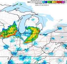
[33] The bow echo intensified into an intense progressive derecho over eastern Iowa and propagated eastward into northern Illinois and southern Wisconsin that afternoon.
[36] The derecho continued eastward, maintaining its strength over southern Lower Michigan and northern Indiana in the early evening hours.