Kaffeklubben Island
[1] The nearest ruins from the older Independence I culture are located at Cape Bridgman, some 80 km (50 mi) to the southeast.
In 1969, a Canadian team calculated that the island's northernmost tip is 750 metres (2,460 ft) farther north than Cape Morris Jesup, the northernmost point of mainland Greenland, thus claiming its record as the most northerly point of land.
[2] Since its record as the northernmost point of land was established, several gravel banks have been discovered in the sea to the north of the island, such as Oodaaq, 83-42, and ATOW1996; however, there is debate as to whether such gravel banks should be considered for the record since they rarely are permanent, being swallowed regularly by the moving ice sheets, being shifted in tides, or becoming submerged in the ocean.
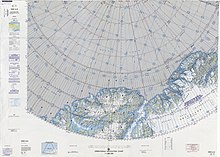
The island lies off Cape James Hill, 10 kilometres (6.2 mi) northwest of Bliss Bay,[4] approximately 37 kilometres (23 mi) east of Cape Morris Jesup, a little east of a central point along the northern coast of Greenland.
[5] Despite the harsh environment, vegetation grows on Kaffeklubben island, including various mosses, liverworts, lichens, and the flowering plants: Saxifraga oppositifolia (purple saxifrage) and Papaver radicatum (arctic poppy).