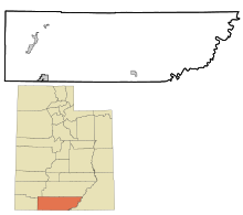
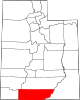
Kane County, Utah
It was named for Col. Thomas L. Kane (1822-1883),[4] a friend of the Latter Day Saint (Mormons) settlers when they first arrived westward, led by patriarch Brigham Young (1801-1877), in the 1840s and 1850s.
[5] Kane County lies on the south line of the state of Utah.
The Colorado River, reformed as Lake Powell, forms its eastern border.
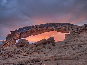
A rugged and inhospitable country of deserts, mountains, and cliffs make up the terrain, with breathtaking scenery in every area.
There were 3,081 households in Kane County with an average size of 2.49 of which 1,987 (64.5%) were families and 1,094 (35.5%) were non-families.
Kane County is part of Utah's 2nd congressional district and thus was represented by moderate Democrat Jim Matheson for several years until 2013.
It was the only county in Utah carried by Alf Landon, the Republican opponent who lost to Franklin Delano Roosevelt in the 1936 Presidential election in the most lopsided Presidential election in over a century.
It has solidly favored the Republican candidate since at least 1956, when Dwight D. Eisenhower received approximately 90% of the vote.