Kanfei Nesharim Street
Unlike most Jerusalem streets, Kanfei Nesharim is a wide thoroughfare with two traffic lanes in each direction, separated by a median, and spans 3 kilometres (1.9 mi) in a straight line.
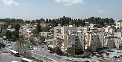
It connects the neighborhood of Kiryat Moshe on the east to Har Nof on the west, and includes the modern commercial strip of office buildings, stores and restaurants in what is termed Givat Shaul Bet.
On 9 April it fought to regain Castel (at Latrun); simultaneously, the Irgun and Lehi forces attacked the Deir Yassin village at the western end of Kanfei Nesharim Street.
The Israelis expelled the surviving residents and repopulated the area with Orthodox Jewish immigrants from Poland, Romania, and Slovakia; the center of the village was renamed Givat Shaul Bet.
In contrast, Beit Hadfus Street, running roughly parallel and to the south, remained largely industrial with discount supermarkets and outlet stores that attract bargain shoppers.