Kanyakumari district
[2] It is also the richest district in Tamil Nadu in terms of per capita income,[3][4] and also tops the state in Human Development Index (HDI), literacy, and education.
However, Marthanda Varma brought a sense of disorder under control by annexing the nearby territories, putting down the feudal lords and establishing the strong state of Travancore.
Key elements of Velu Thampi Dalawa's revolt occurred in the area and the English East India company's army under Col. Leger broke through the fortifications and entered Travancore in 1810.
The rugged landscape boasts bluff ridges and conical peaks, forming a continuation of the Western Ghats that stretches all the way to the Aralvaimozhi Pass.
The variations in altitude and climate across the hilly terrain of the district have led to a diverse vegetation profile, showcasing distinct representations of different land types.
[27] Kodayar originates east of Valia Malai peak within the southern part of the Muthukuzhivayal plateau and flows southwest through a wild tract.
[28] Originating north of Mahendragiri, the Paraliyar, another major river of the district flows southwesterly and passes out of the forest area a mile above Ponmanai[29] where it encounters the Perunchani Dam.
[28] Valliyar a minor river originates at an altitude of 950 m in the Velimalai hills[31] and passes through Kothanalloor, Kalkulam, Eraniel, Thalakulam and Manavalakurichi before joining the Arabian Sea at Kadiapattanam.
[32] The district features diverse topography with its northern and western regions consist of hilly terrain and forests, while the southeastern and central parts are characterised by agricultural lands.
Evidence of this uplift includes deeply entrenched streams, waterfalls, high hanging valleys, alluvial flats, and marine sediment patches at higher elevations.
The distinctive occurrence of feldspathic granites across a significant portion of this region indicates that the rocks underwent intense isoclinal folding, resulting in repeated bands.
Lateral deposits, including sand, zircon, rutile, ilmenite, and garnet, are commonly found along the entire sea coast of Kanyakumari.
[44] As part of the Western Ghats, one of the world's eight hottest biodiversity hotspots,[45] this district boasts a rich diversity of flora and fauna, many of which are endemic to the region.
It constitutes the southern section of the Agastyamalai region, bordered by Kerala's Neyyar Wildlife Sanctuary to the west and Kalakkad Mundanthurai Tiger Reserve to the east.
Most of the forests in the district are situated on slopes of hills and plateaus, benefiting from high rainfall and serving as catchment areas for numerous streams and rivers.
Notable timber trees include teak, rosewood (blackwood), Jungle Jack, Malabar ebony, Adina cordifolia, Karumaruthu, and Vengai.
Tree and shrub species include Adina cordifolia, Cochlospermum religiosum, Dillenia pentagyna Hydnocarpus laurifolius, Lannea coromandelica and Terminalia chebula etc.
Additionally, other herbaceous plants such as Acrotrema arnottianum, Centratherum rangacharii, Exacum travancoricum, Leucas vestita, Linum mysorense, Hedyotis purpurascens, Heracleum candeolleanum, and Senecio ludens thrive.
Common trees found in the interior plains include Cassia siamea, Dichrostachys cinerea, Morinda pubescens, Thespesia populnea, Ficus bengalensis, Mangifera indica, Alstonia scholaris, Pongamia pinnata, and Calophyllum inophyllum.
Climbers like Pterolobium hexapetalum, Lantana camara, Cissus quadrangularis, Aganosma cymosa, Coccinia grandis, Pergularia daemia and Jasminum angustifolium are also frequently encountered in this ecosystem.
[67] The coastal areas face unique challenges due to factors like sandy soil, aridity, scanty rainfall, and strong winds.
More than 100 species, spanning across 90 genera and 46 families including Adenanthera pavonina, Ficus religiosa, Psidium guajava, Ocimum tenuiflorum, Waltheria indica, Dendrobium macrostachyum and Sida acuta were recorded in the sacred groves along the south-west coast of the district.
Within the Acacia woods, cacti, agave, and aloe grow, accompanied by a ground cover of typical xerophytic herbs, including various grasses.
[91] Agastheeswaram, Kottaram, Azhagappapuram, Anjugramam, Thenthamaraikulam, Myladi, Suchindram, Theroor, Marungur, Puthalam, Ganapathipuram, Aralvaimozhi, Boothapandi, Thazhakudi, Azhagiapandiapuram, Reethapuram, Kallukuttam, Neiyyur, Thingalnagar, Eraniel, Mandaikadu, Manavalakurichi, Villukuri, Vellimalai, Vilavur, Kumarapuram, Kothanallur, Verkizhambi, Thiruvithancode, Mulagumudu, Kappiyarai, Valavachaghoshtam, Attoor, Thiruvattar, Kulasekharam, Thiruparappu, Ponmanai, Pudukadai, Killiyur, Karungal, Palapallam, Keezhkulam, Kaliyakkavilai, Nallur, Unnamalaikadai, Pacode, Edaikodu, Pazhugal, Arumanai, Kadayal Rajakkamangalam, Thovalai, Thengapattanam According to the 2011 Census, the district had a population of 1,870,374, comprising 926,345 males and 944,029 females.
Tamil is the most widely spoken language in Kanyakumari district, though there is a significant minority (5.76%) of Malayalam speakers living mainly along the Kerala border.
The statue was sculpted by the Indian sculptor V. Ganapati Sthapati, who also created the Iraivan Temple, and was unveiled on the millennium day of 1 January 2000 by the then Chief Minister M. Karunanidhi.
Hill rock at Chitharal has a cave containing Rock-cut sculptures of Thirthankaras and attendant deities carved inside and outside dating back to 9th Century A.D by King Mahendra Varman I.
Some of the terminating stations are Chennai, Tiruppur, Periyakulam, Kodaikanal, Rameswaram, Thiruchirappalli, Dindigul, Thanjavur, Palani, Salem, Coimbatore, Karaikudi, Kumily, Bodinayakkanur, Erode, and Sivakasi.
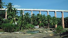
There is rail connectivity from Nagercoil, the district capital, to most parts of the country with daily trains running to Mumbai, Chennai, Bengaluru, Guruvayur, Thiruvananthapuram, madurai, Coimbatore, Trichy, Mangaluru, Tambaram etc.
and weekly trains to New Delhi, Kolkata, Gujarat, Hyderabad, Pondicherry, Bilaspur, Rameswaram, North East India and Jammu and Kashmir.