Kezi River
The Kezi River (Chinese: 克孜河), also marked as Kirzl River (克孜勒河) and Kirzlesu River (克孜勒苏河) on the map of People's Republic of China, is a river in Xinjiang Uygur Autonomous Region[4] of China, located in Kizilsu Kyrgyz Autonomous Prefecture.
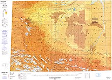
[5] Kezi River originates from the Gora Kurumdy (Kurumdy I Summit) in Kyrgyzstan-Tajikistan border and enters Wuqia County in Xinjiang through the border at Simukhana Pass (斯木哈纳山口), which is the boundary between the Tianshan and Kunlun Mountains.
[8] In China, the river flows from west to east through Wuqia County, Kizilsu Kyrgyz Autonomous Prefecture, Shufu County, Shule County, Kashgar City, Jiashi City, and Bachu County in Kashgar Prefecture,[9] and finally meets the Yarkant River and joins the Tarim River basin.
[10] The Kashi segment (Xinjiang) of Kezi River was badly polluted.
[11] In 2016, the control unit in the Kashgar Prefecture of the Kezi River was upgraded from worse than Grade V to Grade V.[12]