Kham
Kham covers a land area distributed in multiple province-level administrative divisions in present-day China, most of it in Tibet Autonomous Region and Sichuan, with smaller portions located within Qinghai and Yunnan.
[citation needed] As a frontier region, Kham integrated and "Tibetanized" early Mongolian and Chinese populations.
[1] Notable Tibetan Buddhist art from this era, dating from 804 or 816, includes carved stone statues of Buddha Vairocana.
[8] Kham was not controlled by a single king and remained a patchwork of kingdoms, tribes, and chiefdoms whose bases of authority were constantly shifting.
In 1639, Güshri Khan, a supporter of the Dalai Lama, invaded with Mongolian troops and defeated the powerful King of Beri in Kham.
Central Tibet reasserted its authority over the northern parts of Kham and established the Office of the Tibetan High Commissioner to govern.
[10][verification needed] Then in 1896, the Qing Governor of Sichuan attempted to gain control of Nyarong valley during a military attack.
[11] From 1904 to 1911, China decided to reassert its control over the previously re-ceded section of Kham, and to push further into the region[1] soon after the invasion of Tibet by the British army under Francis Younghusband in 1904.
[11] The British invasion alarmed the Qing rulers in China, and they sent Fengquan (鳳全) to Kham to initiate land reforms and reduce the numbers of monks.
[11] In 1905 or 1908[12][13] Zhao began executing monks[3] and destroying many monasteries in Kham and Amdo, implementing an early "sinicization" of the region:[14] He abolished the powers of the Tibetan local leaders and appointed Chinese magistrates in their places.
He introduced new laws that limited the number of lamas and deprived monasteries of their temporal power and inaugurated schemes for having the land cultivated by Chinese immigrants.
Like the later Chinese conquerors, Zhao's men looted and destroyed Tibetan monasteries, melted down religious images and tore up sacred texts to use to line the soles of their boots and, as the Communists were also to do later, Zhao Erfeng worked out a comprehensive scheme for the redevelopment of Tibet that covered military training reclamation work, secular education, trade and administration.
In 1917, the Tibetan army defeated China in battles at Chamdo, west of the Dri River, which were halted after Britain refused to sell Tibet additional armements.
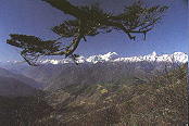
The border between eastern and western Kham is the Upper Yangtze – Dri Chu in Tibetan and Jinsha Jiang respectively, in Chinese.
[19] Kuomintang intelligence reported that some Tibetan tusi chiefs and the Khampa Su Yonghe controlled 80,000 troops in Sichuan, Qinghai, and Tibet.
[21] The Chinese Kuomintang also sought the Khampas help in defending Sichuan from Japan during World War 2, since the temporary capital was located there.
[23] 300 "Khampa bandits" were enlisted into the Kuomintang Consolatory Commission military in Sichuan, where they were part of the effort of the central government of China to penetrated and destabilize the local Han warlords such as Liu Wenhui.
[26] In 1950, following the defeat of the Kuomintang rulers of China by communist forces in the Chinese Civil War, the People's Liberation Army invaded western Kham.
Western Kham was then set up as a separate Qamdo Territory[citation needed], then merged into Tibet Autonomous Region in 1965.