Kingsthorpe
[3] Kingsthorpe continued to grow into the 20th century as residential development moved further northwards and either side of the A508 and A5199 roads.
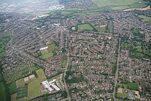
Kingsthorpe is now a large residential area of Northampton which is made up of several neighbourhoods that surround its central shopping front.
[4] Kingsthorpe lies approximately two miles north of Northampton town centre as well as being placed to the west of Abington, to the east of Duston and to the south of Boughton.
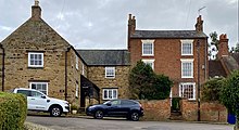
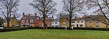
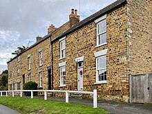
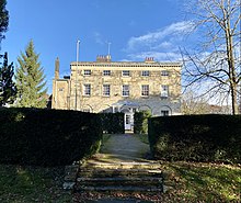
The original village retains a semi-rural character, away from the main roads, overlooked by the parish church and vernacular cottages.
The suburb's amenities are centred on the main A508 and A5199 roads that link central Northampton with Market Harborough and Leicester respectively.
Areas considered part of Kingsthorpe have since grown around the original village, with residential development mainly to the north and either side of the A508 and A5199 roads.
Kingsthorpe was listed in the Domesday Book in 1085 as Torp;[5] at this time it formed part of the demesne of the Crown.
The original parish of Kingsthorpe was large and extended to approximately 1743 acres in 1767,[7] incorporating areas that would now be considered neighbourhoods of present-day Kingsthorpe, as well as parts of Abington and Kingsley to the east, and parts of the Queen's Park and Semilong estates to the south.
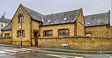
The present Cock Hotel building replaced an older coaching inn which dated back to the 16th century.
[18] Kingsthorpe had provisions for education during the 17th century; the first recorded school building was on the corner of the High Street where it meets The Rise.
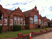
[7] By 1905, Kingsthorpe Grove School was established; the red brick building and its moulded terracotta dressings is listed.
[7] Just opposite, the Kingsthorpe Cemetery opened in 1898 on the eastern side of the road, where it has remained and enlarged since.
In 1912, the local council acquired 21 acres on the east of the Welford Road from the Thornton estate, which later became the Recreation Ground (or 'The Rec' for short) where there were facilities for cricket, football, tennis and bowls as well as a children's playground.
During the second half of the 20th century, housing estates and some industrial developments filled the remaining portions of land within the boundaries of the old parish.
In the early 2000s, alterations were made to demolish part of the centre to extend Waitrose and its car park.
Newer housing developments, including Tollgate Close, Brampton Park and Cedrus Court, were also completed by the 1980s.
Residential development has continued into the 21st century: Bective Close, Lime Tree Gardens and Scholars Court were built on former brownfield land.
Buckton Fields, a large new housing estate built land directly to the north of the border of the Kingsthorpe parish, is still in development.