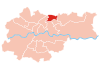
Districts of Kraków
They include the Old Town (Stare Miasto), once contained within the city defensive walls and now encircled by the Planty park; the Wawel, which is the site of the Royal Castle and the Cathedral; Stradom and Kazimierz, the latter originally divided into Christian and Jewish quarters;[2] as well as the ancient town of Kleparz.
Between 1951 and 1973 the city was divided into six districts: Stare Miasto, Zwierzyniec, Kleparz, Grzegórzki, Podgórze and Nowa Huta.
From 1973 until the introduction of the present division in 1991 there were four districts: Śródmieście ("City Centre"), Podgórze, Krowodrza and Nowa Huta.
The names and numbers of the 18 districts are now as follows: Stare Miasto (I), Grzegórzki (II), Prądnik Czerwony (III), Prądnik Biały (IV), Krowodrza (V), Bronowice (VI), Zwierzyniec (VII), Dębniki (VIII), Łagiewniki-Borek Fałęcki (IX), Swoszowice (X), Podgórze Duchackie (XI), Bieżanów-Prokocim (XII), Podgórze (XIII), Czyżyny (XIV), Mistrzejowice (XV), Bieńczyce (XVI), Wzgórza Krzesławickie (XVII), and Nowa Huta (XVIII).
Kraków's historic centre, covering the Old Town, Wawel and Kazimierz, was entered on the UNESCO list of World Heritage Sites in 1978.
Medieval Kraków was surrounded by a 1.9 mile (3 km) defensive wall complete with 46 towers and seven main entrances leading through them.
It leads down Floriańska Street through the Main Square, and up Grodzka to Wawel, the former seat of Polish royalty overlooking the Vistula river.
[6] It borders the districts of Stare Miasto to the west, Prądnik Czerwony to the north, Czyżyny to the east, and Podgórze across the river to the south.
It consists of neighbourhoods called Dąbie, Grzegórzki, Olsza (partly in Prądnik Czerwony), Osiedle Oficerskie and Wesoła.
[7] It borders Prądnik Biały to the north-west, Mistrzejowice and Czyżyny to the east, and Stare Miasto and Grzegórzki to the south.
[9] It borders Stare Miasto to the east, Zwierzyniec to the south, Bronowice to the west and Prądnik Biały to the north.
[11] It borders Bronowice and Krowodrza to the north, Stare Miasto to the east, and Dębniki to the south (across the Vistula).
It includes the neighbourhoods (former villages) of Bielany, Chełm, Olszanica, Półwsie Zwierzynieckie, Przegorzały, Wola Justowska, Zakamycze and Zwierzyniec, and the Salwator estate.
[12] It contains the former villages of Bodzów, Dębniki, Kapelanka, Kobierzyn, Koło Tynieckie, Kostrze, Ludwinów, Podgórki Tynieckie, Pychowice, Sidzina, Skotniki, Tyniec and Zakrzówek, the neighbourhoods of Kliny Zacisze and Mochnaniec, as well as a number of newly built estates.
It includes the Swoszowice spa neighbourhood, as well as the neighbourhoods of Bania, Barycz, Jugowice, Kliny Borkowskie, Kosocice, Lusina, Łysa Góra ("Bald Mount"), Opatkowice, Rajsko, Siarczana Góra ("Sulphur Mount"), Soboniowice, Wróblowice and Zbydniowice.
[15] It borders Podgórze to the north, Bieżanów-Prokocim to the east, Swoszowice to the south and Łagiewniki-Borek Fałęcki to the west.
[17] Initially a fishing village at the foot of Lasota Hill, it was granted city status by the Austrian Emperor Joseph II in 1784.
Carl's Bridge, linking Podgórze with Kraków proper across the Vistula and located between today's Mostowa and Brodzińskiego streets, was built in 1802 and destroyed by a flood just 11 years later in 1813.
[19] It borders Grzegórzki, Prądnik Czerwony, Mistrzejowice, Bieńczyce, Nowa Huta, and (to the south, across the river) Podgórze.
[21] It borders Czyżyny to the south-west, Mistrzejowice to the north-west, Wzgórza Krzesławickie, to the north-east, and Nowa Huta to the south-east.
The district of Wzgórza Krzesławickie comprises the former villages of Dłubnia, Grębałów, Kantorowice, Krzesławice, Lubocza, Łuczanowice, Wadów, Węgrzynowice, and Zesławice.
[22] Nowa Huta (literally "New Steel Mill") is the easternmost district of Kraków, numbered XVIII.
The historic area of present-day Nowa Huta is one of the few places in Poland settled continuously since the neolithic period.
[23] Nowa Huta was built from the ground up in 1949 as a separate town near Kraków on terrain resumed by the Communist Government from former villages of Mogiła, Pleszów and Krzesławice.
Since the fall of Communism the city district that was once a showpiece for Stalinism now boasts many tributes to ardent anti-Communism.
Streets formerly named after Lenin and the Cuban Revolution have been renamed to honor Pope John Paul II and the Polish exile leader Władysław Anders.
In 2004 Plac Centralny, Nowa Huta's central square which once was home to a giant statue of Lenin - on display at High Chaparral Museum in Hillerstorp Sweden, was renamed Ronald Reagan Central Square (Plac Centralny im.