Krumbach, Bavaria
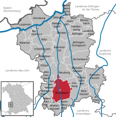
Krumbach (elevation 512 m (1680 ft)) is situated in Mittelschwaben in the natural region Lower Iller-Lech Gravel Plateau (a part of the region between Danube and the Alps) in the valley of the Kammel, a left tributary of the Mindel river and so an indirect tributary of the Danube river.
The landscape is marked by forests and areas in agricultural acreage (fields and grassland).
Until the time of the Third Reich Hürben had a high percentage of Jewish residents in comparison to the Bavarian average.
Bavarian regional reforms merged the previously independent municipalities of Hohenraunau (1972/01/01), Billenhausen with Hirschfelden (1972/07/01), Edenhausen with the Krumbad (1973/01/01), Attenhausen (1977/01/01) and Niederraunau (1978/05/01) into Krumbach.
The colours of the town (red and white) as well as the arms (a silver-coloured wavy thick line in red) remind one on the one hand of the long affiliation to Further Austria on the other hand it is a canting arms – the crooked stream.