Kwajalein Atoll
An airstrip, somewhat longer than 300 m (1,000 ft) running north–south at the southeastern end of the island provided STOL service to the base, although the strong prevailing winds from the west made for very tricky landings.
[17] Enubuj (Āne-buoj, [ænʲeːbˠuotʲ][1]), or "Carlson" Islet which was its 1944 World War II U.S. operation codename, is situated next to Kwajalein to the northwest, directly west of Little Bustard.
Ennylabegan (Āneeļļap-kaņ, [ænʲeːllˠɑbʲ(ɛ)ɡɑnˠ][1]), or "Carlos" Islet, is the site of a small Marshall Islander community that has decreased in size in recent decades; it was once a bigger village.
Enmat (Enm̧aat, [ɛnʲ(ʌ)mˠɑːtˠ][1]) is mo̧ or taboo, birthplace of the irooj (chiefly families) and off-limits to anyone without the blessing of the Iroijlaplap (paramount chief).
[33] Japan had developed an interest in what it called the "South Seas" (南洋, Nan'yō) in the 19th century, prior to its imperial expansion into Korea and China.
[37] At the outbreak of World War I in Europe, Japan joined the Triple Entente and seized the Marshall Islands against only token resistance.
In 1922 the islands were placed under Japanese administration as a League of Nations Mandate, whereupon it was referred to as Kwezerin-kanshō (クェゼリン環礁) in Japan, part of the Nan'yō gunto.
In some regions of the Nan'yō, colonial settlers outnumbered Micronesian natives by as much as ten to one, amounting to the most significant violation of Japan's League of Nations mandate.
[41] Prior to the attack on Pearl Harbor, militarization of the Nan'yō, including Kwajalein, had been considered meagre enough that it alarmed Admiral Shigeyoshi Inoue, who in January 1941 strongly urged the Ministry of the Navy to immediately expedite the process.
[citation needed] In order to build the aerial runway on Kwajalein Island, the Japanese public school was demolished and, along with the civil administration, moved to Namu Atoll.
[43] Archaeological evidence as well as testimony from Japanese and Marshallese sources indicate that this militarization would likely not have begun until the 1940s; it was left incomplete at the time of the American invasion in 1944.
The supply ships that were meant to provide them with food rations were sunk by American forces before reaching the atoll; many Japanese succumbed to illnesses like dengue fever and dysentery, as did many of the laborers.
[52] Some Marshallese were reportedly induced to fight by Japanese propaganda which, as would occur later in the Battle of Okinawa, stated that the Americans would indiscriminately rape and massacre the civilian population if they successfully took the atoll.
After the war ended, the United States used it as a main command center and preparation base in 1946 for Operation Crossroads, the first of several series of nuclear tests (comprising a total of 67 blasts) at the Marshall island atolls of Bikini and Enewetak.
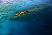
[citation needed] The battleship USS Pennsylvania was sunk in the ocean off Kwajalein Atoll after being exposed during atomic bomb testing on 10 February 1948.
But it reiterated its stance that the Compact renegotiation was already completed and that it expected the Republic of the Marshall Islands to abide by the Military Use and Operating Rights Agreement (MUORA) it agreed to in 2003.
Nevertheless, the enormous investment in these new technologies and recent statements by Army leadership[56] indicate that the United States is committed to remaining in the Marshall Islands at Kwajalein Atoll for the foreseeable future.
[citation needed] Kwajalein Atoll has been leased by the United States for missile testing and other operations from well before independence for the Marshall Islands.
[60] RTS includes radar installations, optics, telemetry, and communications equipment, which are used for ballistic missile and missile-interceptor testing, and for space operations support.
U.S. Marine Corps intelligence records and photographs at the U.S. National Archives, together with the testimony of U.S. veterans, indicate that there was a mass-burial site consolidated into one place on Kwajalein islet, at or near the current cemetery.
[62] The United States designated most of the island of Kwajalein and all of Roi-Namur as National Historic Landmarks in 1985, in recognition of the role those places played during World War II.
The island also has a food court with a Subway, Burger King, and American Eatery, as well as a bar for evening drinking and relaxation.
"Landowners" here refers to the consortium of irooj (chiefs), alaps (clan heads) and rijerbal (workers) who have land rights to the places used for military purposes by the United States.
[68][69] Although Operation Homecoming did not achieve the level of recognition for all people with land title at Kwajalein, the resulting agreements at least set a precedent for future dealings with the United States government.
[70] Article 3 of the MUORA obligated the RMI to lease specific sites from their owners through a Land Use Agreement (LUA) and then sub-lease them to the United States.
The first MUORA guaranteed total payments of roughly US$11 million to the landowners through the year 2016, the majority of which went, via the provisions of the LUA to the irooj (chiefs), who had the largest stake in the land.
In advance of its expiration in 2016, this LUA was renegotiated in 2003 as part of the Compact of Free Association, with the U.S. agreeing to pay the landowners (by the Republic of the Marshall Islands) $15 million a year, adjusted for inflation.
The Compact stated that if the Republic of the Marshall Islands and the landowners did not reach an agreement about land payments by the end of 2008, these funds in escrow would be returned to the U.S. Treasury.
Referring to this incentive to reach an agreement, then-Senator Tony deBrum stated that it would be "insane" for the Marshallese people to put up with another 70 years of lack of access.
[79] Kwajalein is twinned with: The atoll is the setting of a clandestine spacecraft launch site in Neal Shusterman's third novel in his Arc of a Scythe series, The Toll.