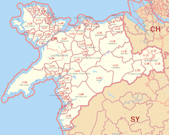
LL postcode area
The LL postcode area, also known as the Llandudno postcode area,[2] is a group of 67 postcode districts, within 62 post towns.
These cover the majority of north and north-west Wales, plus a very small part of the English county of Shropshire.
The districts start at LL11 so as to avoid confusion with Liverpool postcodes (LL1–9 would resemble L11–19).
The post towns are: The approximate coverage of the postcode districts: