Lake Kampeska
It is located west-northwest of Watertown, South Dakota and lies entirely within Codington County and the Coteau des Prairies.
[2] Lake Kampeska is connected to the Big Sioux River through a single inlet-outlet channel located on the northeast side.
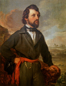
"[3] Famous pathfinder John C. Fremont and scientist Joseph Nicollet explored this region of Dakota Territory approximately in May or June 1838.
Codington, a Congregational clergyman, carved out the geographical location for the purpose of making the area a county-seat town.
[3] Towards the end of the 1870s, the northern shore of Lake Kampeska was designated by Arthur C. Mellette and territorial officials to serve as the location of the Capitol Building.
However, when Benjamin Harrison signed South Dakota into statehood, the designation was changed to the geographic center of the state.
Lake Kampeska is a popular site for recreational activities including fishing, sail boating, biking, swimming, waterskiing, camping, and picnicking.
Many of the paintings of the lake have received national interest, featured in Ducks Unlimited and on the cover of Farmer Magazine.
[11] Among others, Neal Tapio, Nancy Turbak Berry, Fred H. Hildebrandt, Doron Jensen, and Arthur C. Mellette have previously maintained residences on the lake.